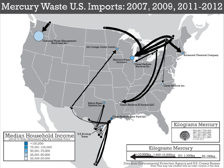
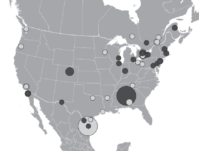
Mercury waste is a known human hazard and has appeared in numerous records in our dataset. The flow map below shows mercury waste movement from 2007, 2009, and 2011-2012 at the national level. The second flow map below shows the exact same data, but at the site level. To create this site level map, we used origin and destination coordinates from our assembled dataset for records filtered to those having mercury in the hazardous waste description. Flow lines were drawn on the map, showing connections between exporting facilities and importing facilities, sized based on the amount of waste transferred, and shaded according to median household income levels. As seen on the map, mercury waste was transported to many different places in the United States from many different places in Canada and Mexico, and amounts varied by shipment. Both trends are invisible in the first map. Mercury waste wasn’t just transported to the nearest state across the border. There were multiple instances where the mercury waste traveled across many states before it reached its destination. For example, mercury waste was shipped from Ontario and Quebec all the way to Clean Harbors El Dorado in Arkansas.