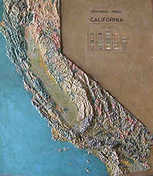
 The 19 relief maps displayed in Science Hall are part of the history of science at UW-Madison—and the U.S. They were created for classroom and museum use between 1870-1930, a time much like today when the scientific community struggled to understand the complex forces of the earth that shaped human lives: the geologic age of the Grand Canyon, the invisible tectonic forces that fracture Utah and California landscapes, and the scale of global environmental change in glacier elds. The maps in Science Hall were created at a time when science was bursting with new techniques and fields: topographic contours, photogrammetry, human environment interaction, and academic fields of paleontology and fluvial geomorphology. When you contemplate our relief map collection, remember, too, that most of these maps had been created before aerial photography or space imagery. We should preserve these maps as a reminder that every generation of students—from 1870 to 2013—is challenged at UW-Madison with participating in that history of science—moving knowledge forward one idea at a time. Most of us do not make the great discoveries of our time. But all of us do move science forward as these maps did—in the small ways that add up to greatness: teaching our children to love science, working in our communities, becoming stewards of science in our lives!
Due to the generous support of our alumni, we have raised nearly $6,000 for the restoration of our historic relief maps. To date, 15 maps have been restored to their former glory. We are now seeking funds to restore the remaining four maps and create printed materials for visitors, and possible an audio walking tour recording.
Help support our efforts to restore these historic relief models.


