
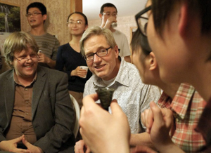
Prof. Jim Burt announced that he will retire this August after 32 years in the UW–Madison Geography Department. Jim and his wife Jan will host a retirement celebration at their rural home in Middleton on Sunday, September 6th. Everyone is welcome to join them! Please RSVP for the event here.
Jim Burt came to the UW in 1983 after three years as an Assistant Professor at the University of Illinois. Like all beginning faculty, he quickly engaged in the teaching mission of the Department. At various times he would teach eight different undergraduate courses. Most recently his rotation consisted of courses in physical geography (Geog 120 and 321), quantitative methods (360 and 560), and GIS (378). At the graduate level he offered occasional seminars, chaired Ph.D. and Master’s committees in Geography, and served on many others inside and outside of Geography.
Jim played an important role in our GIS Certificate Program: he drafted the program proposal in the late 1990s (at the encouragement of former colleague Jim Knox) and shared oversight responsibility with other GIS faculty until Karen Tuerk (GIS Cert ’02) was hired as Program Manager in 2003. Over the years Jim worked with many certificate students on their projects and still supervises quite a number of them. He also helped plan the recently approved Professional Master’s Program and developed an online course for the program just prior to his retirement.
 Jim is a co-author of three college textbooks, two of which are the most widely used book in their subject area. A fourth book is under contract. He works with our own Joe Mason on two of these, and with UW geography alum Ed Aguado (Ph.D. 1983) on another.
Jim was a successful classroom teacher and is well-known for developing animations and instructional simulation models. He was very well respected and liked by his students. He received a Chancellor’s Distinguished Teaching Award in 1994.
Jim’s research was in physical geography during the first part of his career. Most of that work was in climatology using numerical models and statistical methods. His research migrated increasingly toward GIS beginning in the late 1990s when A-Xing Zhu invited him to collaborate on the SoLIM project, which provides an umbrella framework for predictive modeling of environmental variables that cannot be easily observed or mapped by direct survey or remote sensing techniques. A-Xing and Jim worked with graduate students and agency colleagues on many projects, mostly related to soils using a mix of approaches including expert systems, data mining and fuzzy logic. The group developed novel methods for large-area high-resolution digital soil surveys and produced the first county-wide digital survey in the country (for Dane County, about 700,00 acres). They devised techniques to extract tacit knowledge from soil experts, created tools that mined traditional soil survey maps for latent information on soil-environment relations, and pioneered the incorporation of uncertainty in soil predictions. Jim also had a long-standing interest in geospatial tool development. The 3dMapper software he and A-Xing wrote more than a dozen years ago was the first program to offer 3-d polygon editing on terrain, and it was adopted by the Natural Resources Conservation Service nationwide for use in soil survey updates. Even today it remains unmatched for speed and visualization capabilities.

About five years ago Jim became interested in ways to bring historical maps into the world of modern GIScience. Working with certificate student Ken Then (GIS Cert ’12), grad student Jeremy White (now graphics editor at The New York Times), and USGS National Science Publishing Director Greg Allord (UW Cartography B.A. ’76), Jim developed new approaches for automated map image rectification. The entire historical collection of the U.S. Geological Survey (about 180,000 maps) was processed by their software, and to date there have been more than 10 million downloads of the resulting images from the U.S. National Map. [One wonders why they did not ask for a small royalty on each download—they could have endowed a chair in Geography!] In a follow-up project they developed a georeferencing program that discovers the underlying map projection in scanned images of small-scale maps. Their work has attracted the attention of map librarians, archivists and historical cartographers as well as GIS specialists—over 100 people are signed up for a workshop on the software at the ESRI user’s conference later this month.
At present Jim is working with grad student Yuying Chen on ways to locate undocumented abandoned mines on scanned historical maps. The American West has tens of thousands of such features, many of which are a significant natural hazard (especially uranium mines on tribal lands) or have important mineral resource value.
Jim says that he has truly loved working with students and other colleagues over the decades, but that he won’t miss the administrative side of research at all, particularly proposal-writing. (During his time at UW Jim was Principal Investigator or Co-Principal Investigator on projects totaling about $2.5M in extramural funding, mainly from NSF, USDA/NRCS, and USGS.)
Jim served the discipline in most of the usual ways: manuscript and proposals reviews, faculty promotion recommendations, external program reviews, membership on journal editorial boards and professional society committees. On campus he sat on wide variety of both elected and appointed committees. Within the Department he probably served on every standing committee and chaired most of them. He was often appointed to ad-hoc committees and was repeatedly elected to the Advisory and Budget Committees. Jim survived four years as Chair of the Department in the early 2000s, a fact he attributes to support from a forgiving faculty and patient instruction from the office staff, especially Cheryl Murray (who taught him how things really work at UW).
Jim’s plans for retirement include some project work, auditing a number of great courses at UW (geography profs beware!), travel with Jan, and time just being a grandfather.


