 |
 |
 |
 |
 |
![]()
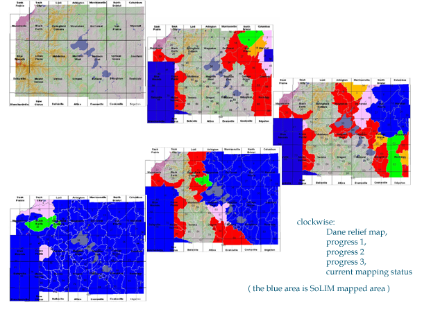
The project is to update the soil survey of Dane county, Wisconsin using the SoLIM approach, which combines local soil expert knowledge with GIS techniques under fuzzy logic for soil mapping. The objective of this project is to develop a discovery prototype for improving the quality and efficiency of soil survey, by developing a set of streamlined and operational procedures for using the SoLIM approach in soil survey. This set of procedures can then be used elsewhere across the nation (with localization). The project has the following specific objectives:
To develop a set of procedures which are applicable elsewhere in the nation for soil mapping using the SoLIM approach.
To
develop a linkage to the NASIS database for maintaining the local expertise
on soil-landscape relationships obtained through the SoLIM approach.
![]()
SoLIM
is fast, accurate
and less expensive.
speed:
The speed is
about 1,000 acres per person per day. The product is already in digital
form, no need to digitize it. Currently the speed of manual mapping (including
compilation and digitization) is about 80-100 acres per person per day.
products and
accuracy:
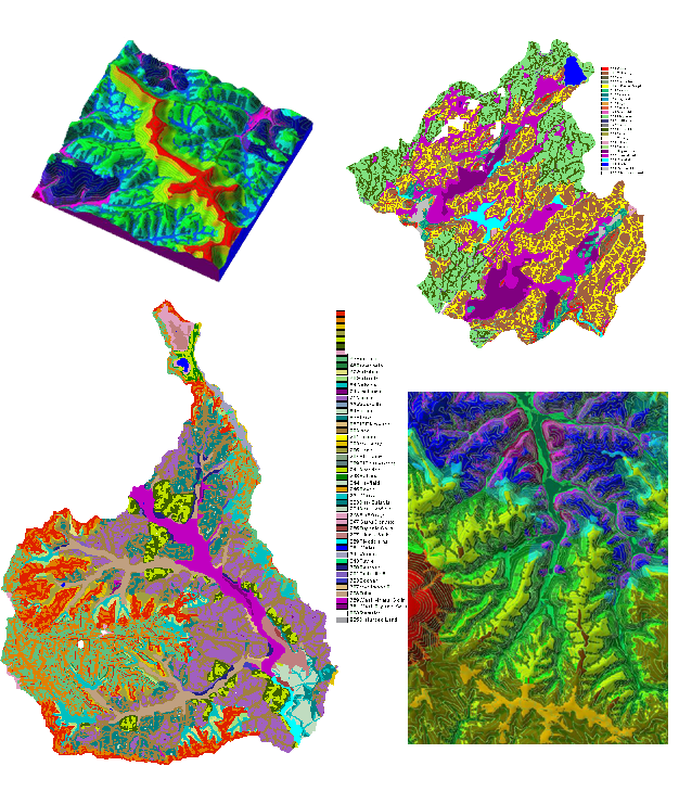
SoLIM products include fuzzy membership maps and hardened(thematic) maps.
Fuzzy membership maps depict gradual soil change across space. Hardened
maps are parallel to conventional maps, while with finer details. If neccessary,
hardened maps can be easily vectorized. Below are SoLIM mapping accuracies
in parts of Dane:
| Accuracy: Inferred vs. Field Observed | |||
| Correct | Incorrect | Accuracy | |
| Blue Mounds NE |
34 | 4 | 89% |
| Cross Plain SW | 22 | 6 | 78% |
| Watershed24 |
31 | 9 | 77% |
expense:
Cost about $1.5 million to complete field mapping of the County using
the manual approach. Cost about $0.5 million using the SoLIM approach
in digital form.
![]()
![]()
![]()
![]()
![]()
![]()