Making a hardened map from a set of soil fuzzy membership maps assigns each pixel the ID of the soil type which has the maximum fuzzy membership value at the site. This ID is the unique ID (number) in the soil type name used in the knowledge file.
Select "Product Derivation->Hardened Map"
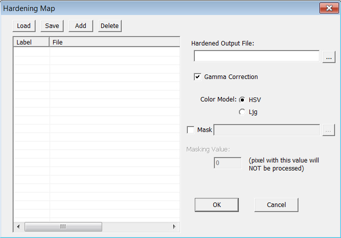
click on "Add" to add a soil fuzzy membership map to the list.
click on "Delete" to remove the selected soil fuzzy membership map.
click on "Save" to save the list into a list file for future use.The list file record the labels and corresponding soil fuzzy membership maps.
click on "Load" to load an existing list.
Specify the hardened output file.
Gamma correction and color model options are used to set the color effect for the output files when they are visualized in 3dMapper.
If you want to use mask, uncheck the box next to "Mask" and specify a mask file.
Click on "OK" to harden soil fuzzy membership maps in the list. If the hardening process is finished successfully, three files should be created in the in the same directory. One is the hardened map, the other two files are entropy map and exaggerated uncertainty map, respectively. For example, if your hardened output file is "HardenUnMap.3dr", the entropy file is named "HardenUnMapEnt.3dr" and the exaggerated uncertainty file is named "HardenUnMapExg.3dr". The entropy map and exaggerated uncertainty map are used to indicate the uncertainty at each pixel when assigning a soil class to that location. For detailed information, please refer to Appendix D.