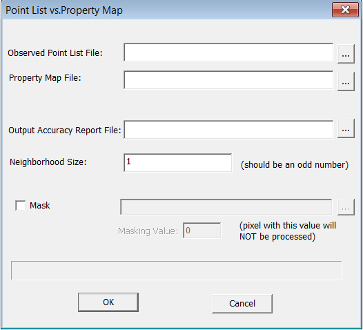
Select "Validation->Property Validation", you can create accuracy report for property map.
Observed point list file contains information about the samples locations. A point file has the following format:
PointID X Y PropertyValue
index1 X1 Y1 property1
index2 X2 Y2 property2
......
The first row contains the column headings. The first column contains the IDs assigned to the sample points. Xs and Ys are the coordinates for the points. PropertyValues are the observed property values at sample locations.
Property map file should be in .3dr format.
Neighborhood size defines a window over which the mean properties will be retrieved as the inferred property value.
If you want to use mask, uncheck the box next to "Mask" and specify a mask file.
The output is a accuracy report which contains following four pieces of statistical information and the point list:
| • | RMSE (Root Mean Squared Error) |
| • | Agreement Coefficient; |
| • | Mean Absolute Error and |
| • | Standard Deviation of Observed Values. |