This masking function is an "in or out" function. It simply classifies all the locations covered by the environmental database into two classes: locations that should be included in the inference and locations that should be excluded from the inference. The masking function is mainly for defining the mapping area when you want to set a special boundary for the output soil map, e.g., when you only want to map the soils within a watershed or specific areas. If the value of a pixel in the mask file equals to the specified Masking Value, the corresponding pixel in the output soil map will be assigned Nodata. Otherwise pixels will receive inference results.
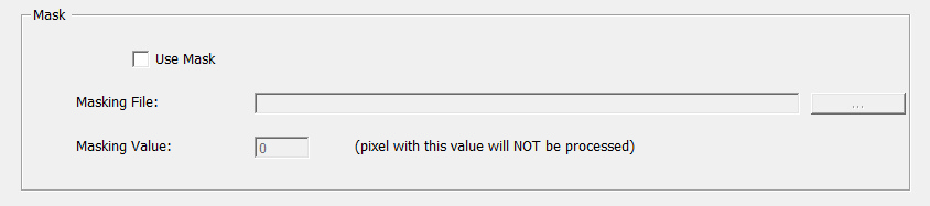
Enable Mask:
In the Inference View, Check the box next to "Mask" . This will enables the masking function and also activates the other options in the "Mask" area. Leaving the Mask box unchecked disables the masking function.
Set Masking File
Click on ![]() in the "Mask" area to open a masking file. A Masking file should be .3dr file of integer type and its extent should be the same with the first data layer in the current GIS database.
in the "Mask" area to open a masking file. A Masking file should be .3dr file of integer type and its extent should be the same with the first data layer in the current GIS database.
Set Masking Value
Input an integer number as masking value.