Select "Utilities->Sampling" to generate a set of samples using user-defined sampling scheme:
Four sample strategies are available:
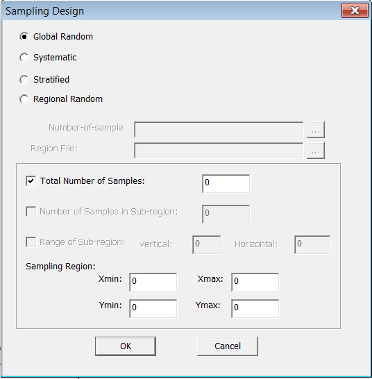
Method: Global Random
Every pixel in the entire area has an equal chance of being selected. You need to define the total number of samples and the sampling region.
Total Number of Samples
The total number of samples to be generated.
Xmin
The minimum value of X coordinate value.
Xmax
The maximum value of X coordinate value.
Ymin
The minimum value of Y coordinate value.
Ymax
The maximum value of Y coordinate value.
Method: Systematic
After you defined the sample size, every Nth record is selected from a list of pixels. As long as the list does not contain any hidden order, this method is as good as the random sampling method. Its only advantage over the global random sampling method is simplicity.
Total Number of Samples
The total number of samples to be generated.
Xmin
The minimum value of X coordinate value.
Xmax
The maximum value of X coordinate value.
Ymin
The minimum value of Y coordinate value.
Ymax
The maximum value of Y coordinate value.
Method: Stratified
Besides number of samples and sampling region, you have to define the number of samples in sub-region and range of sub-region. The program will randomly generate the same number of samples for each sub-region.
Total Number of Samples
The total number of samples to be generated.
Number of samples in Sub-region
The number of samples in each sub region.
Vertical
The vertical length of a sub region.
Horizontal
The horizontal length of a sub region.
Xmin
The minimum value of X coordinate value.
Xmax
The maximum value of X coordinate value.
Ymin
The minimum value of Y coordinate value.
Ymax
The maximum value of Y coordinate value.
Method: Regional Random
Unlike stratified sampling, you can have the program generate different number of samples for different sub-regions. The definition of regions is an ArcGIS Coverage ungenerated polygon text file.
number of samples file
A text file to tell the program how many samples to be generated for each polygon.
Region File
an ArcGIS Coverage ungenerated polygon text file.