The soil maps created by SoLIM Solutions are fuzzy membership maps indicating how similar the soils at different locations are to the most typical cases of the specified soil types. The resulting maps use the raster data model and are in .3dr format.
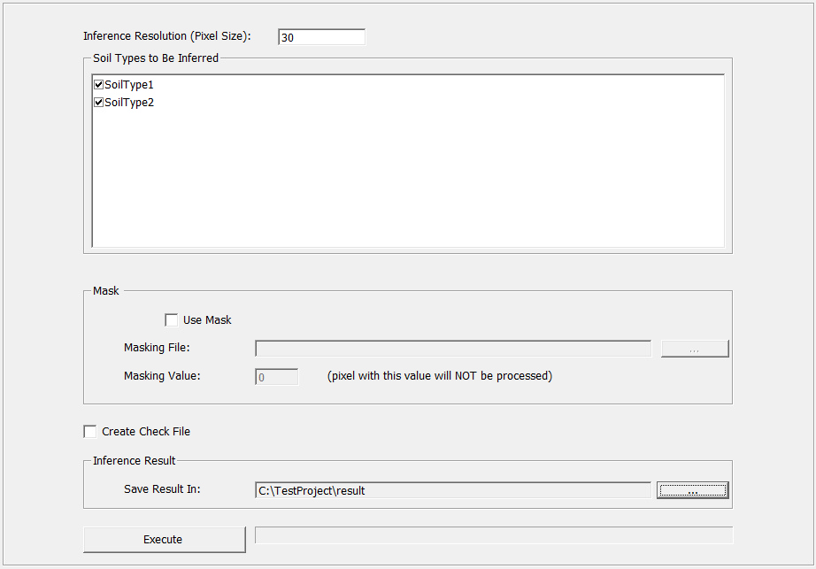
This section provides the instructions to operate the soil inference in SoLIM Solutions. With the functionalities provided by the program, you can choose soil types to be inferred, set mask file, create check files and run inference.
In the control panel, click on "Inference" node to unfold it. Under that node, click on "Inference", the view will shift to Inference View.
Soil inference is done through the following interface: