Who We Are
Since 1953, the UW Cartography Lab has been a center of innovation for map design, interactive visualization, and geographic thinking. The Cart Lab is a unique “maker”-space in which researchers, professional designers, and students work together to discuss complex problems and create compelling visuals. We are continuously engaged with our extensive #uwcart alumni network and are always eager to seek new clients and partnerships on campus and beyond. Read more about us…
What We Do
The Cart Lab is a full-service cartographic design facility integrating production, research, and educational activities. We support the cartography and design needs of the UW system and regularly contract with government agencies, scholars, and instructors. Each partnership generates real-world student apprenticeships on mapping projects that sit at the intersection of research and design. Contact us if you are interested in working with the Cart Lab…
Why We Map
Maps are more than just pretty pictures. Maps tell stories. Maps provide explanations. Maps make arguments. As geographers, we view maps and map-based applications as essential tools for addressing complex geographic problems and promoting place-based dialogue. To this end, we bring passion and experience to each new project in order to meet your mapping needs. Browse past production, research, and educational projects…
Follow us @UWCartLab and #uwcart
Contact Us
Site Map
UW Cartography in the News!
- The 10th Annual Cart Lab Design Challenge: Co-Creating a Historical Atlas of Racial Violence
- Geography students, faculty, and staff participate in 2023 International Cartographic Conference
- Cart Lab Design Challenge 2023: Visualizing the Evolution of the Great Plains
- Design Challenge 2022: K-5 Geography Curriculum Development
- A Design Challenge for Transforming Justice
- UW Madison Cartography Lab’s “We Are Here: Local Mapmakers Explore The World That Connects Us” Exhibit
- We Are Here: Local Mapmakers Explore the World That Connects Us
- New Book Highlights Importance of Cartography in Achieving SDGs
Featured Cart Lab Projects

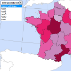
Web Mapping: A Workbook for Interactive Cartography and Visualization on the Open Web
Robert Roth, Carl Sack, Gareth Baldrica-Franklin, Yuying Chen, Rich Donohue, Lily Houtman, Tim Prestby, Robin Tolochko, and Nick Underwood
This workbook introduces the practical skills needed to develop interactive maps and visualizations on the open web. Compared to a traditional textbook, this workbook utilizes a "spiral" curriculum of short but interconnected lessons that incrementally build proficiency in interactive cartography and visualization.

Mapping for a Sustainable World
Robert Roth
The University of Wisconsin Cartography Lab supported creation of the book layout and all maps and graphics through National Science Foundation CAREER Grant #1555267

GIS&T Body of Knowledge
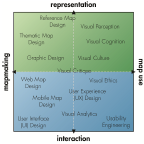
The GIS&T Body of Knowledge documents the domain of geographic information science and its associated technologies (GIS&T). By providing this content in a new digital format, UCGIS aims to continue supporting the GIS&T higher education community and its connections with the practitioners, employers, and clients who comprise the increasingly diverse collection of GIS&T professionals. The UW Cartography Lab actively supports and contributes to the GIS&T body of knowledge.
 Welcome to the UW Cartography Lab Website


