By: Professors Robert Roth and Joe Mason, and graduate student Jake Steinberg
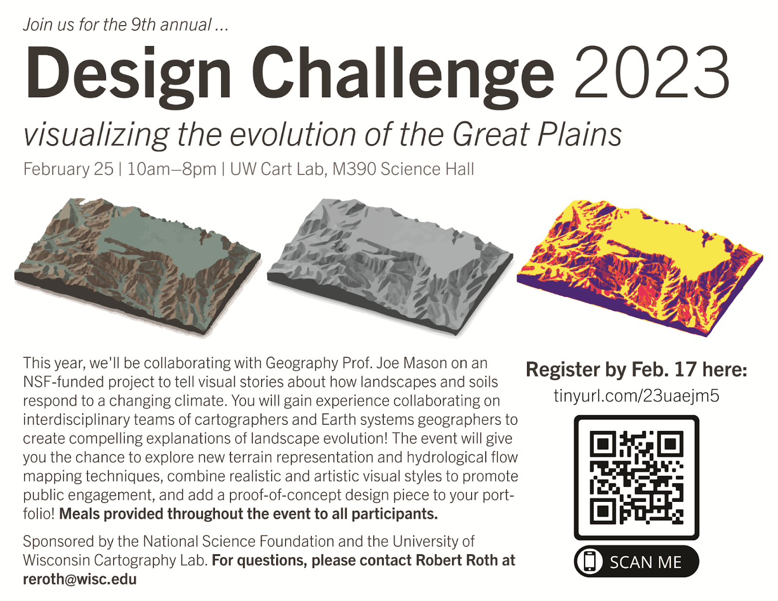
The UW Cartography Lab and University of Wisconsin-Madison Geography Lab held its 9th Annual Design Challenge on Saturday, February 25th. The Cart Lab Design Challenge is a daylong “lock-in”-like mapping workshop that brings faculty, staff, and student partners together around a complex geographic problem. Specifically, the Design Challenge enables students to tinker and innovate around a common spatial dataset and user need, providing an opportunity to push themselves technologically and creatively while also adding a piece into their map portfolios. For examples of past collaborations, read more about the 2016, 2018, 2019, and 2021 Cart Lab Design Challenges.
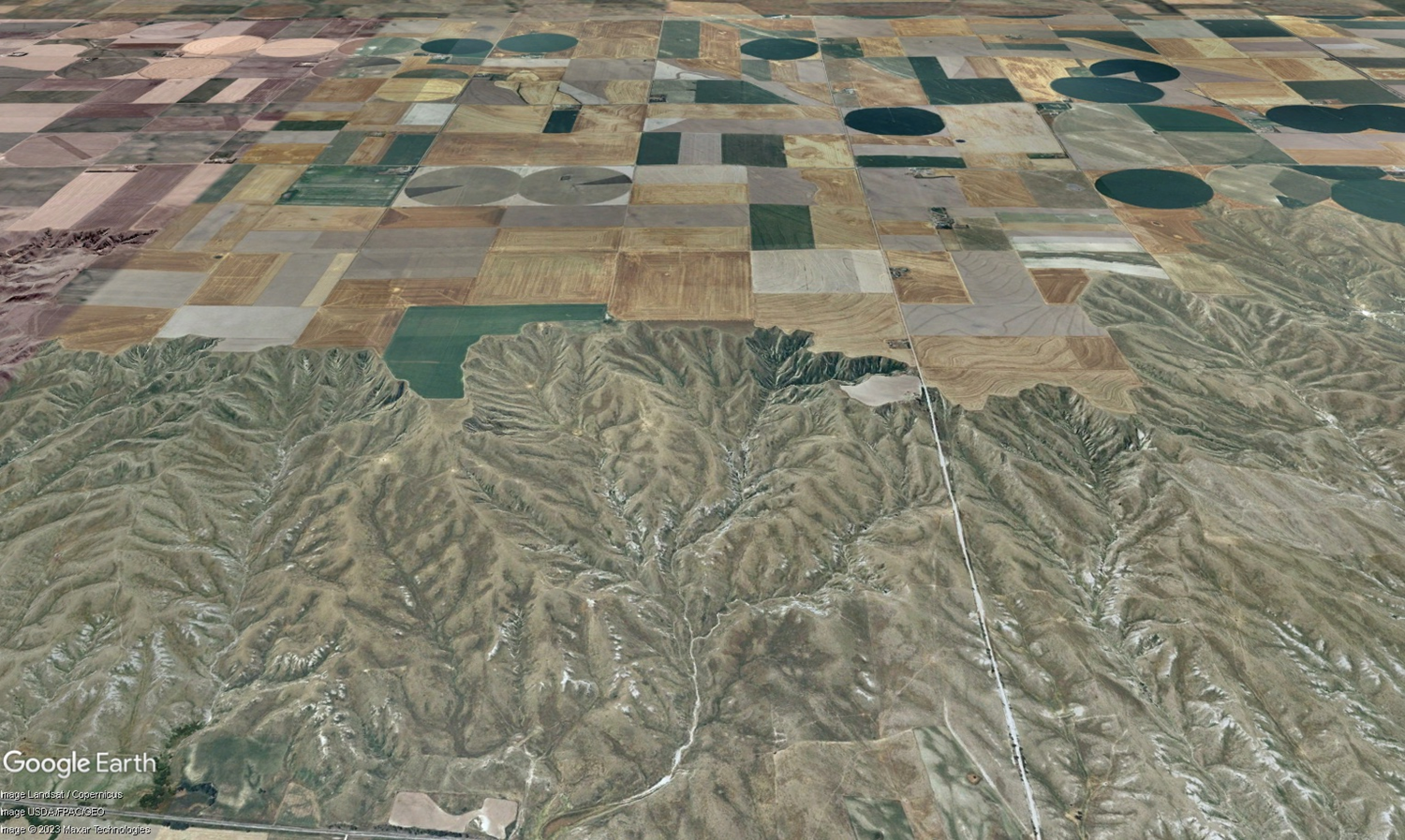
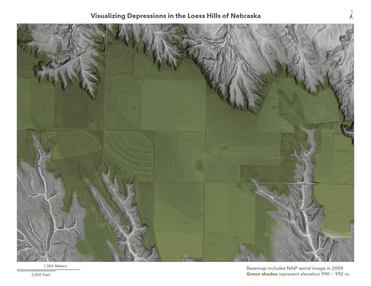
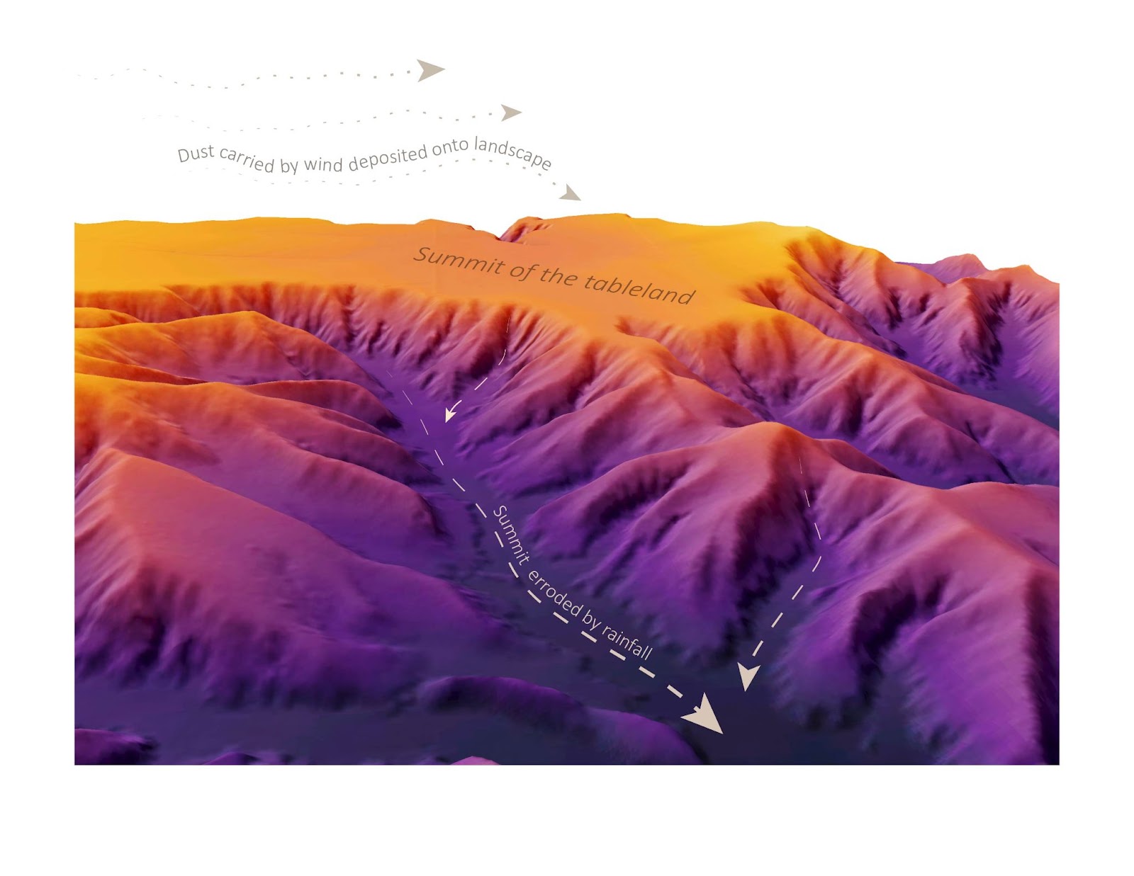
This year, we collaborated with Geography Prof. Joe Mason on an NSF-funded project to tell visual stories about how landscapes and soils in the central Great Plains respond to a changing climate. The Design Challenge focused specifically on loess tablelands, where productive agricultural land and carbon-rich surface and buried soils border abruptly on steep, rapidly eroding slopes. The NSF grant funded research on how erosion of these tablelands varied through past climates and how it will respond to a future climate with both more frequent drought and more frequent extreme precipitation events. Local residents in the study area are interested in the results, but more effective visual stories are clearly needed to communicate project findings to a broad audience. The proposal that the NSF funded specifically included a Cart Lab Design Challenge with that goal.
A total of 27 students–the largest Design Challenge to-date–joined us the morning of February 25th, with the event kickstarting with breakfast and an inspiration lecture by Prof. Mason that outlined three visual stories needed for communicating about loess tableland evolution to local communities:
Story 1: Convey landscape evolution of the loess tablelands of the Great Plains, under changing past and future climate conditions
Story 2: Model surface runoff and erosion on these tablelands, and evaluate human impacts on runoff paths.
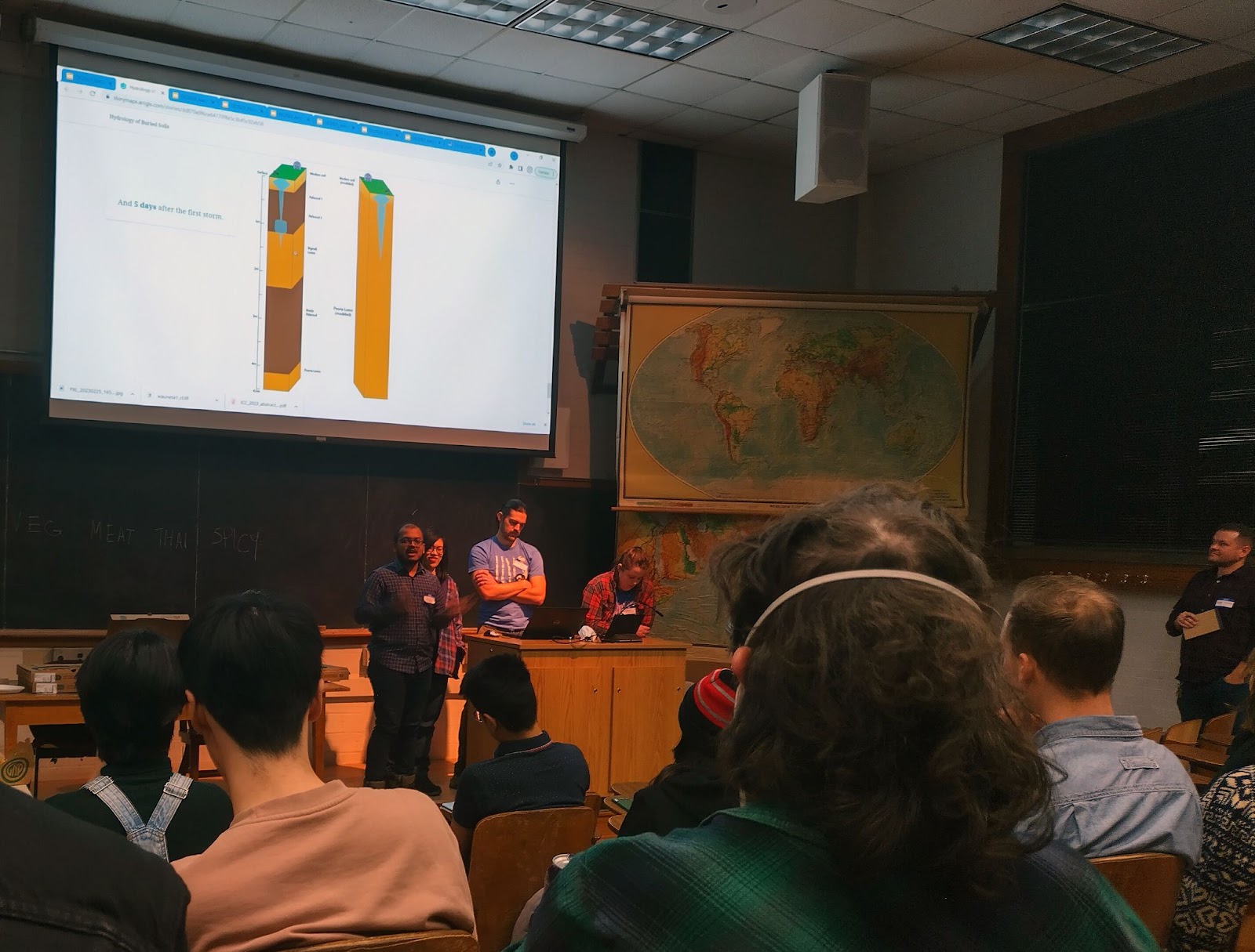
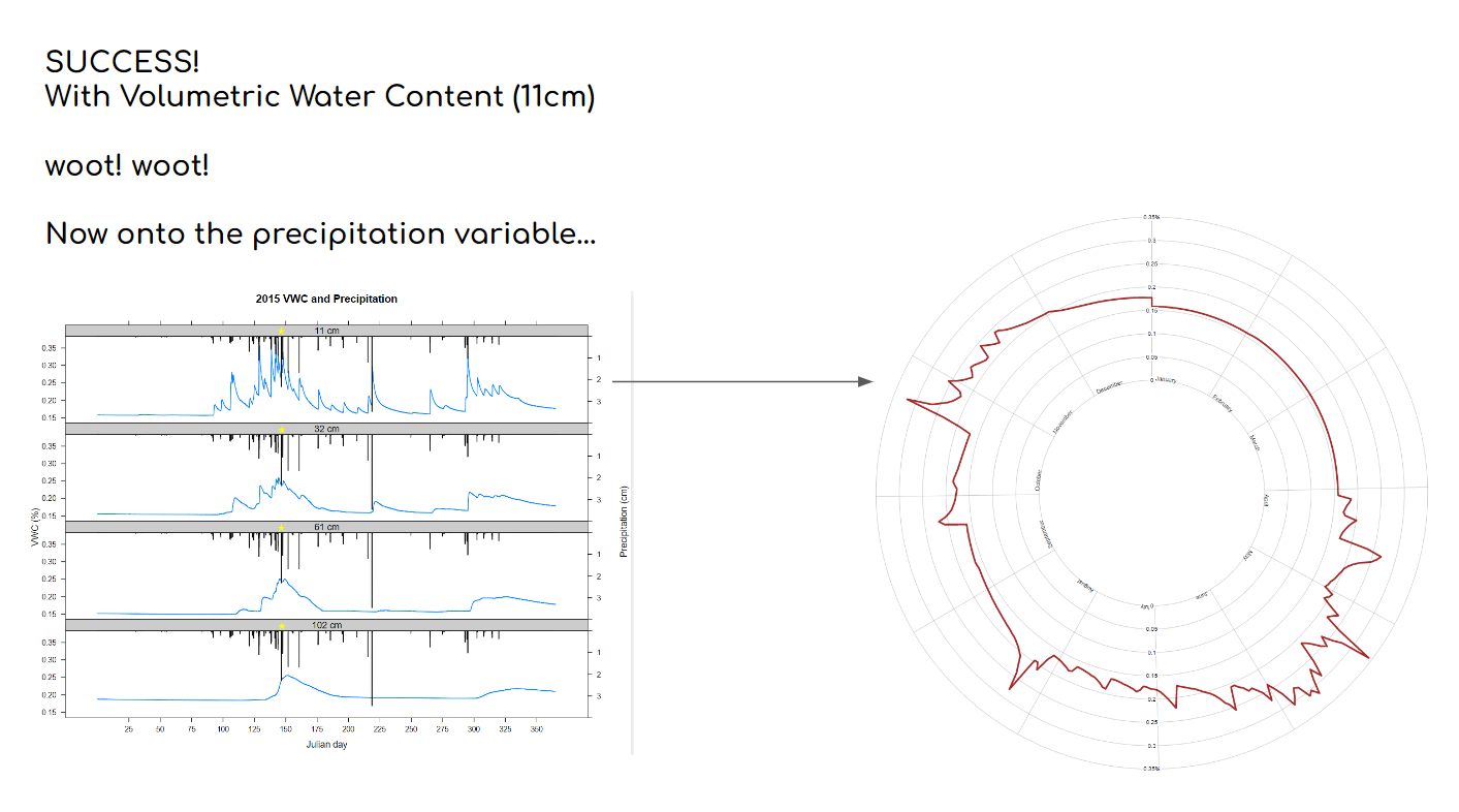
Story 3: Visualize water movement in surface and buried soils and how it influences soil carbon storage and vegetation resilience in a changing climate.
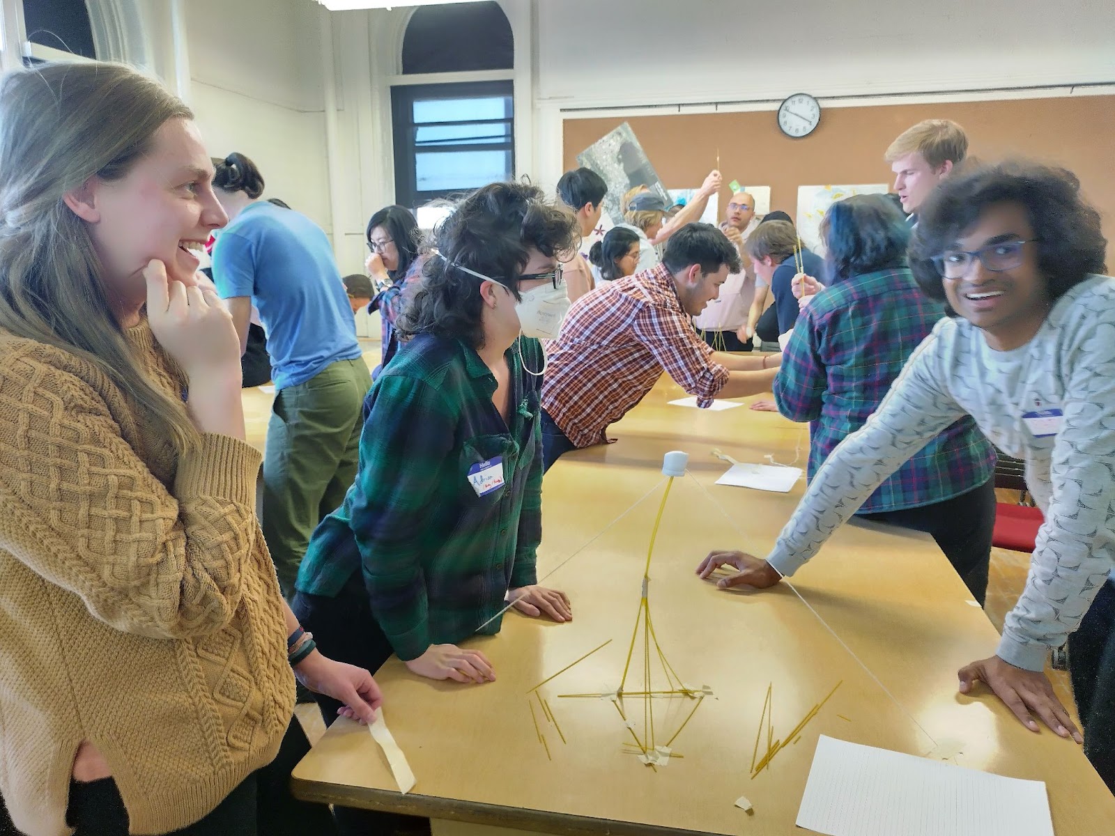
Following the inspiration lecture, students spent an hour brainstorming ideas and forming interdisciplinary teams that blended complementary backgrounds in cartography and Earth science. Teams then worked on their designs in three design sprints, separated by lunch and a creative afternoon break. Finally, teams shared their design prototypes over dinner, giving the overall group a chance to collectively reflect on major challenges, breakthroughs, and innovations from the day.
The event was an overwhelming success, both in developing new ideas for visualizing the evolution of the Great Plans as well as hosting transdisciplinary conversations across Geography. Among the many achievements include experimental terrain representation techniques using new mapping libraries, new approaches for hydrological flow mapping and space-time visualization, and the combination of realistic and artistic visual styles to promote public engagement.
Special thanks to the 2023 Design Challenge organizers: Joe Mason, Taylor McDowell, Robert Roth, and Jake Steinberg. The organizers plan on expanding upon the maps and graphics developed at the Design Challenge to develop a public-facing website supporting visual science communication of research on loess tablelands in the Great Plains, and will be seeking feedback from community members in western Nebraska as part of the broader impacts component of the NSF grant.
The 2023 Design Challenge was funded by NSF Grant EAR-1920625


