Add Data Layer(s)
1. Right click on the "GIS Database" node. In the pop-up menu, select "Add Layer".
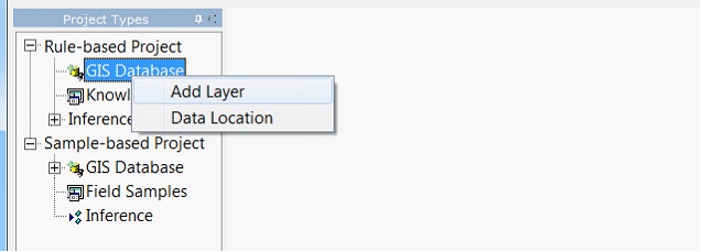
2. In the add layer dialog, choose one or more data files. The recommended file format is 3dr format. However, SoLIM Solutions can convert other commonly-used raster file format (e.g. TIFF, ERDAS IMAGE) to .3dr format on the fly. SoLIM Solutions can also rasterize commonly-used vector file format (e.g Shapefile) into 3dr format on the fly.
3. click on "OK", The data layer is added to the current project and copied into the GISData directory of the current project. If the layer is not valid, SoLIM will pop up a error dialog and the layer will not be added.
Tips :
1. The default name of a data layer is the "data name" stored in the header of the .3dr file.
2. The name of a newly-added data layer MUST BE DIFFERENT from the names of ALL OF THE EXISTING data layers in the project.
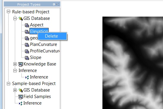
Delete a Data Layer
In the control panel, right click on the name of the data layer to be deleted.Click on "Delete".
Tips
1. The data layer is only REMOVED from the list. The data layer file still in the GISData directory.
2. If a layer is deleted, the rules which attach with the this layer will be removed: the attached rule will be set to NULL.