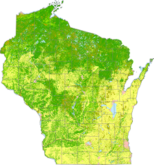
 The University of Wisconsin-Madison and Wisconsin Department of Natural Resources (DNR) are partnering on a project to map the current land cover of Wisconsin. The resulting digital database will replace a statewide land cover map created by DNR using 1991-1993 data. The State Cartographer’s Office (SCO) is coordinating the overall effort. A Science Team from the UW-Madison Department of Forest and Wildlife Ecology, led by Dr. Mutlu Ozdogan, is managing the technical implementation.
The WiscLand 2 project will run from May 1, 2014 to June 30, 2016 with $450,000 funding provided by the U.S. Fish & Wildlife Service through the Pittman-Robertson Wildlife Restoration Act. One of the main drivers behind the project is DNR’s desire to improve whitetail deer habitat monitoring. The need for an improved statewide land cover database was specifically cited in a 2012 report by Deer Trustee Dr. James Kroll.
In addition, an accurate and up-to-date statewide land cover map will allow the DNR forestry division to map the distribution of tree types important to Wisconsin’s economy. More generally, land cover maps are used to monitor biodiversity, habitat loss, effects of climate change, and track land management decisions over time.
For more information visit the land cover project page on the SCO Web site. To join the distribution list and receive periodic e-mail updates from the project team, send a blank e-mail message to join-landcover@lists.wisc.edu and follow the instructions you receive via e-mail.


