
SoLIM Results
Accuracy
The SoLIM approach has been tested at several sites and has achieved over 80 percent accuracy when compared with field observations. The accuracy of good conventional maps is about 60 percent.
Map Products
SoLIM produces two categories of output: the map products (various forms) and the extracted soil-landscape model (various formulations).
Among the map products, there are fuzzy membership maps, raster soil categorical maps, uncertainty maps, and conventional soil polygon maps.
 |
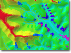
Fuzzy membership maps show the continuous gradation of membership of soils for a given soil type, assisting soil interpretation by providing more finely-grained soil spatial variation. |
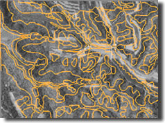 |
Conventional soil maps can also be created by filtering out the small soil bodies from the detailed raster soil categorical maps. Inevitably some soil polygons will include small "island" soil bodies. These inclusions can be reported on a soil polygon basis, a substantial improvement over the conventional concept of mapping units. |
 |
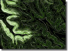
Detailed raster soil categorical maps contain soil bodies as small as a single pixel. This type of soil map is much more detailed than traditional soil maps. Uncertainty associated with the creation of the raster map from fuzzy membership maps can be produced to assess the validity of assigning local soils to prescribed soil types. |
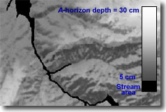 |
Soil property maps, created using SoLIM fuzzy membership maps, can provide data concerning soil properties such as A-horizon depth and hydraulic conductivity at a previously unavailable high resolution. |
|
|
Knowledge Products
The extracted soil-landscape model knowledge can be documented in several ways:
- Catenary sequences
- Dichotomous keys
- Soil-environment descriptions
- Tacit points (typical locations for each soil type)
- Fuzzy membership functions
These separate aspects of knowledge can be studied by current and future
soil scientists, and can also be reused in future soil survey updates.
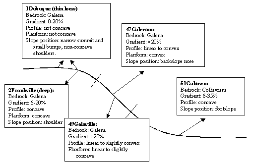
Example of Catenary Sequence
Return to About SoLIM