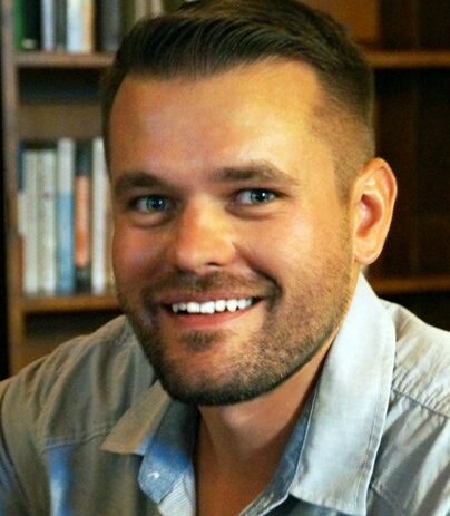
Meet Rob:
My name is Robert Roth and I go by Rob (he/him). I research and teach cartography and visualization, and probably am most known for my work on interactive, web, and mobile map design (the focus of my 575 course!), although I’m increasingly interested in narrative cartography and data journalism (a topic in my 572 course!). I received my PhD in Geography from Penn State, but before that completed a BS and MS in Cartography & GIS here at UW-Madison. Thus, the UW-Madison programs are really near and dear to my heart!
Research Areas:
My research areas are in cartography and visualization. Specifically I research the design of interactive, online, and mobile maps, with specific emphasis on human-computer interaction and UI/UX design (user interface/user experience), user-centered design and usability engineering processes, visual storytelling and data journalism, and collaborative and community-engaged mapping.
How did you initially become interested in GIS and geospatial technologies?
My path to cartography and GIS is a bit circuitous. I remember being fixated on becoming an architect when I was pre-teen and used to draw detailed plans of buildings and cities (along with lots of other visual art; I was always drawing). I tended to excel in math and science courses, but rebelled in high school and wanted to be a visual artist / art teacher despite my family putting the typical pressure on me to be one of the big three: doctor, lawyer, engineer. I honestly had no idea about my major when I arrived in Madison as a freshman undergrad, and just happened to take Geography 101 (Introduction to Human Geography) my first semester to satisfy a writing requirement (coincidentally, with my current colleague Prof Kris Olds in one of his first semesters on campus). I liked how Geography provided a cross-disciplinary, integrative way of thinking about the world versus often more siloed and reductive sciences and mathematics, and I particularly liked how Kris used visuals (maps, photographs, documentaries) to illustrate the examples and case studies in the course. I took Geography 370 (Introduction to Cartography) the following semester and was hooked immediately by the combination of the very quantitative and technological GIS skills with the highly qualitative and creative cartographic design process. Cartography is Exhibit A against the classic left-brained/right-brained construct! To this day, I feel like I tricked my family into thinking I have taken an engineering career path when I know cartography and GIS are so much more!
What do you think today’s students could learn in their classes that will help their futures?
Our programs and courses in cartography and GIS emphasize full stack development, and I can’t say enough how important it is to get exposure to a range of technologies for doing full stack development during your studies instead of focusing on just a single technology or stack. As mentioned above, disruptive technological change is inevitable, and as you progress in your career you will need to be able to survey the landscape of available technologies and make informed decisions about which stacks currently fill your institutional or client needs. There is a real fear of being “path dependent” or utilizing a given technology long after there are better or cheaper available alternatives. Thus, taking a full-stack approach that mixes open source and proprietary technologies sets you up not just for your first career in the geospatial industry, but we hope also gives you the background and context to help you with your final career in the industry.
What path led you to GISPP at UW-Madison?
One of the “pillars” of my tenure case was on pedagogy, particularly on how to keep pace with the rapid evolution of technology in our discipline. We see disruptive changes in the underlying GIS technology every 2-3 years and even relatively stable technologies require regular maintenance. I think the most I have ever assigned the same lab sequence is two consecutive semesters, which makes Cartography and GIS somewhat unique on this campus where new teaching materials are expected to be relevant for 5-7 years or even more. To this end, I used my resident version of Geography 575 as a “living laboratory” to test strategies for keeping pace with changes in geospatial technology. What has worked is a highly modular approach that keeps technical content on GitHub, allowing for versioning control and portability for both in-person and online formats. When the Director position opened, it seemed like a good opportunity to continue this pedagogical work and develop new strategies for maintaining our curriculum beyond the cartography and visualization courses. I officially will be Director for a three-year span 2021-2024, after which I will be handing over to Prof. Jonathan Nelson.
If you could go back in time, what is one piece of advice you would give yourself?
Wear suntan lotion!
But seriously, I think a main piece of advice that I didn’t realize when I was a starting student is to emphasize your portfolio throughout your studies. We assign the portfolio lab in Geography 572, but every assignment in every course is an opportunity to add something meaningful to your portfolio. Your portfolios are a great way to demonstrate your interests and skills to employers, so choose datasets and designs that you are passionate about. I am really surprised with how frequently employers discover your work through your portfolio, so putting extra thought into the lab topics you choose will allow the courses to “work for you” as you enter the job market. Your portfolio also is a great way to assess your own deficiencies, and so study example descriptions for your “dream job” and choose projects and technologies in Geography 777 and 778 that infill any gaps as you move towards your job applications.