By Howard Veregin
August 24, 2023
A team of researchers from Wisconsin and Minnesota has been awarded a $139,000 grant from NOAA’s National Estuarine Research Reserve System (NERRS) Science Collaborative to complete a habitat map of the St. Louis River estuary. The project team includes staff from the Wisconsin State Cartographer’s Office (SCO), the Lake Superior National Estuarine Research Reserve (LSNERR), the Natural Resources Research Institute (NRRI) at the University of Minnesota-Duluth, U-Spatial at the University of Minnesota-Twin Cities, and several independent contractors. Official announcement of the award was made in July, 2023.
The St. Louis River estuary, which runs along the boundary between Wisconsin and Minnesota in the Duluth-Superior (“Twin Ports”) metro area, is one of the largest coastal wetlands ecosystems along Lake Superior. It is a vital resource ecologically, culturally and economically. The estuary is part of a Great Lakes Area of Concern designated in 1987 because of historical activities that have led to impairments of fish and wildlife habitat. Examples of these activities include unregulated municipal and industrial waste disposal, poor land use practices, damaging logging and manufacturing activities and dredging and filling of aquatic habitats.
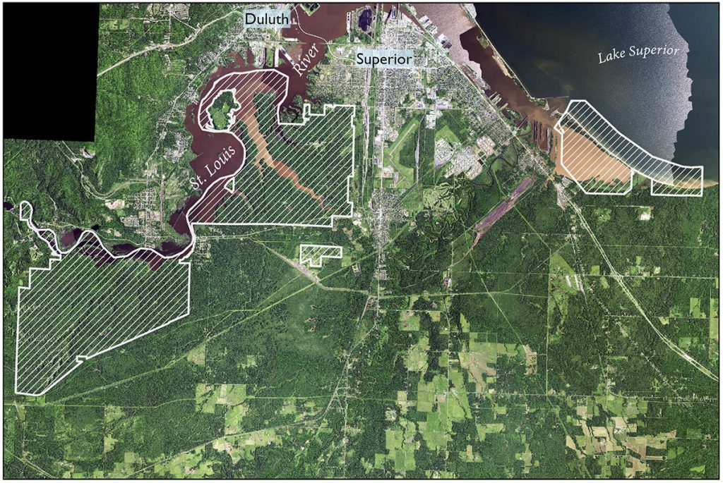
Lake Superior NERR boundaries (in white) and St. Louis River Estuary. (True-color NAIP image)
The NERRS Science Collaborative grant is the third in a series of awards to the SCO and LSNERR to perform habitat mapping in the region. In 2022, the SCO and LSNERR received a UW-Madison Division of Extension Innovation Grant and in 2023, a Wisconsin Idea Collaboration Grant from the Office of the Vice Chancellor for Research and Graduate Education in partnership with the UW-Madison Division of Extension and WARF. Howard Veregin, Wisconsin State Cartographer, and Kirsten Rhude, Stewardship Coordinator at the LSNERR, have served as project leads on all three of the projects. Administratively, the SCO is housed within the Department of Geography at UW-Madison while the LSNERR is part of the UW-Madison Division of Extension’s Natural Resources Institute.
The 2022 Innovation Grant project was designed to develop a remote sensing workflow to create a habitat map within the boundaries of the LSNERR, using the NERRS habitat and land cover classification scheme. The LSNERR boundaries encompass some 17,000 acres on the Wisconsin side of the St. Louis River estuary. This project employed SCO student interns Param Bhandare and Chang Li — both students at UW-Madison — as well as Zach Johnson, a student from Fond du Lac Tribal and Community College (FDLTCC) in Cloquet, Minnesota.
The goal of the 2023 Wisconsin Idea Collaboration Grant project is to collect training data for remote sensing image classification. Two students, Emily Lockling from the University of Minnesota-Duluth and Chris Susnik from UW-Superior, in collaboration with project consultants Carol Reschke and Kelly Beaster, have mapped over one thousand training site polygons using a tablet-based Esri Field Maps collection tool developed by SCO staffer (and UW-Madison Geography grad student) Christina Dennis.
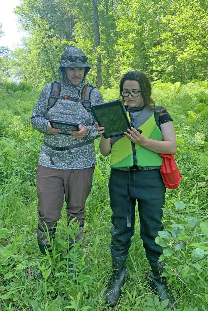
Chris Susnik and Emily Lockling conducting fieldwork, summer 2023.
Other partners on the habitat mapping projects include Carl Sack — Geographic Information Systems Faculty at FDLTCC (and an alum of the UW-Madison Geography department) — NOAA Office for Coastal Management staff (who are providing technical assistance) and other local experts.
The NERRS Science Collaborative project begins in October 2023. The project team includes Howard Veregin and Ann Buschhaus from the SCO, Kirsten Rhude from the NERR, Jeffery Thompson and Olena Boiko from U-Spatial, Kristi Nixon (also a UW-Madison Geography alum) from NRRI, and consultants Carol Reschke and Kelly Beaster.
The NERRS Science Collaborative project will transfer tools and methods for habitat mapping for the LSNERR to the entire St. Louis River estuary. The project will apply mapping techniques to the estuary and the surrounding uplands within a mile radius, to support estuary-wide habitat restoration planning and vulnerability assessment. The project responds directly to the needs of the St. Louis River Habitat Workgroup, a coalition of local, state and federal government agencies, tribal organizations, professional associations, universities and private citizens. The workgroup has begun to update a 21-year-old habitat plan for the estuary and is in need of a current habitat map to help evaluate restoration successes and prioritize future needs. An additional product from the project will be a change analysis report comparing habitat maps from 2002 (the date of the latest habitat map of the estuary) with 2024 to analyze important habitat shifts over the last two decades.


