We are discontinuing the Online Master of Science in Cartography & GIS – GIS Development. We are no longer accepting applications for this program, and we do not plan to offer online programs in the future.
Become a confident GIS programmer and acquire the tools you need to serve as an expert and leader in the geospatial field.
At a Glance
REQUIREMENTS
8 courses; 32 credits
TIME TO COMPLETE
as little as 3 semesters (1 year)
CLASSES
100% online and asynchronous
TUITION
$800 per credit hour
WHEN TO START
Fall, Spring, or Summer semester
PREREQUISITES
Undergraduate degree; 3.0+ GPA; 1 undergraduate GIS course; 1 undergraduate cartography course; 1 undergraduate statistics course
Develop Your Knowledge in Cartography & Geographic Information Systems
The GIS industry is online. Programming, mobile app creation, web map scripting, UI/UX design, and geodatabase management are now crucial skills for anyone who wants to join the geospatial world—so we designed our online master’s degree to focus specifically on those skill areas.
Our Online Master of Science in Cartography & GIS – GIS Development program consists of eight preselected courses. These courses will develop the GIS programming competencies you need, all while building critical spatial analysis skills and reinforcing the importance of user-friendly design. Our flexible program is offered completely online, so you can complete your courses around the demands of your career, from anywhere in the world.
After you earn your master’s degree through this program, you’ll have the tools you need to advance your career in the GIS world. You’ll also have access to our strong alumni network and lifelong learning versions of the courses you completed—so whenever we update our curriculum to incorporate the latest technologies, you’ll benefit from it.
What You'll Learn

In-Depth Map Design
Tell stories with your maps as you take your cartography skills to the next level, creating experiences that are interactive and mobile-friendly.

Geocomputing
Immerse yourself in theory, techniques, and analytical methods for geospatial data; use Python and GIS tools and libraries to store, process, analyze, and visualize.

Full Stack Programming
Bridge the gap between front-end development skills and the additional back-end development skills needed for deploying a complete web mapping application.
Courses
To earn our online master’s degree in cartography & GIS, you’ll complete 8 preselected courses.
Geog 378 Intro to Geocomputing (4 credit hours)
Geog 572 Graphic Design in Cartography (4 credit hours)
Geog 574 Spatial Databases (4 credit hours)
Geog 575 Interactive Cartography & Geovisualization (4 credit hours)
Geog 576 Spatial Web & Mobile Programming (4 credit hours)
Geog 579 GIS & Spatial Analysis (4 credit hours)
Geog 777 Capstone in GIS Development (4 credit hours)
Geog 778 Practicum in GIS Development (4 credit hours)
Full-time students generally complete 3 courses (12 credits) each in their first two semesters, and then complete the capstone and practicum courses together in their third semester. (We don’t recommend this track for those who are also working full-time jobs.)
Part-time students generally complete 1 to 2 courses (4 to 8 credits) per semester and graduate in 2 to 3 years.
"In addition to the web and database development skills essential to my new career, GISPP has given me a framework to justify my design decisions to editors and reporters to better serve our community."
Andrew Hahn, online master's program graduate
Who You'll Meet
Students in our online master’s degree program come from all over the world. They represent a wide variety of career paths and interests, including archaeology, urban planning, law enforcement, surveying, engineering, environmental studies, and much more. As a student, you’ll be able to connect with fellow students and past alums to deepen your connections in the GIS world and grow your professional network. Read about some recent online master’s degree students and why they joined the program:
What You'll Work On
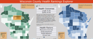
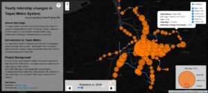
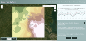
One key strength of our program is its focus on building your portfolio—something tangible you can use to demonstrate your specific skills and interests to potential employers. You’ll create many portfolio-worthy projects throughout your time in the program, but in Geog 778, Practicum in GIS Development, you’ll create something particularly special. Students in this final class take all the knowledge they’ve gained from our program and fuse it with personal, real-world subject matter. End result? Every 778 student walks out of the classroom (or whatever home office or coffee shop they’ve been working in) with a substantive portfolio piece they can talk about with pride. See a few examples below, and then explore more.

Advancing Your Career in GIS
Innovation happens at an extraordinary pace in the cartography and GIS world. Being part of a field that’s fast-paced and always on the cusp of something brand new can be a deeply satisfying experience.
But taking the next step in your career can be tricky in an industry where new technologies are constantly evolving. Our instructional team—a unique blend of internationally recognized cartography/GIS faculty and in-the-field geospatial industry experts—understands how to help our students focus in on the competencies and capabilities that will matter most in the future. With the skills you learn here, you’ll have everything you need to give your career the boost that it needs.
Studying Cartography & GIS at UW–Madison
We take great pride in our technology-centered curriculum and how it bridges the gap between cartographic design and GIS development. We take even more pride in our instructional team, built of internationally recognized faculty and geospatial industry experts.
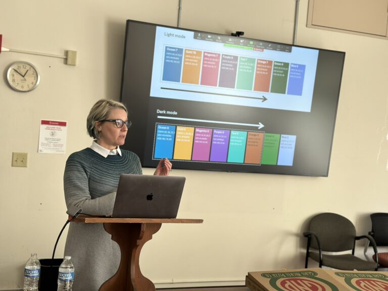
But our program is about more than what happens during your 32 credit hours. We’ll give you opportunities to connect with students in all of our programs and working professionals in our alumni network. And Map Chat, our informal monthly lecture series, brings you talks with experts from all corners of the geospatial and cartography world.

Getting a Head Start with Transfer Credits
We value GIS and cartography work that you’ve completed elsewhere, and we’ll do our best to honor that work. The online master’s program allows you to transfer in credits from the following sources:
• Undergraduate course credits from UW–Madison: up to 7 credits
• Graduate course credits from UW–Madison or other institutions: up to 7 credits
• University Special Student credits from UW–Madison (GIS Fundamentals Capstone Certificate and/or Advanced GIS Capstone Certificate courses): up to 15 credits
Per Graduate School policy, any prior coursework must have been rigorous and meet the expectations of graduate work for the program. Coursework earned five or more years prior to admission to a master’s degree will not satisfy requirements. Visit the Graduate Guide for more detail regarding credit transfers and program requirements.


