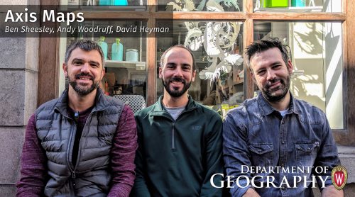
This week’s Geography Alumni profile is with three of the key leaders behind Axis Maps: David Heyman (Managing Director), Ben Sheesley (Design Lead), and Andy Woodruff (Development Lead). David, Ben, and Andy all hail from Science Hall and went on after graduation to found Axis Maps, a digital cartography company that produces interactive maps for the web.
As it says on the company website, when they founded the company in 2006 they were “surprised to see that the cartographic fundamentals and traditions we studied in grad school were falling by the wayside. Many new maps focused on the technical aspects of delivering geographic content over the web rather than clear communication through cartographic design. We formed Axis Maps to bring Cartography to what was becoming a technical field. While other companies focused on algorithms, we developed intuitive user-interfaces. When they built software to reach the broadest market possible, we designed custom maps to make sure each map was right for our client.”
Read our Q&A with David, Ben, and Andy to learn more about what led them from Science Hall to their innovative work with Axis Maps.
I think Cartography (and by extension Geography) is a very thoughtful discipline. Marks on a page (or in our case pixels on a screen), are made with purpose where each one communicates something specific but also comes together to form a meaningful whole. I think this “seeing the forest AND the trees” approach is a useful way to approach many different kinds of problems. -David Heyman
What drew you to be a geography major at UW?
David Heyman (Managing Director): I came to UW for grad school so I already knew I wanted to study cartography. I chose the program at UW because it had such incredible history but also at the time had a very forward-thinking approach to what at the time was the emerging field of interactive cartography.
Ben Sheesley (Design Lead): I started as an environmental science grad, which at the time was located in the basement of Science Hall. When I realized what was happening upstairs, particularly in the Cartography Lab, I knew I had to move up in the world. One visit to the lab in particular, I saw Onno Brower carefully inspecting the amazing Wisconsin Bike map, which was spread out all over a large light table. The art and science of mapmaking made a deep impression on me at that moment. Although I never ended up working in the Cart Lab, I soon found myself with The History of Cartography Project and began charting my course toward a Geography degree.
Andy Woodruff (Development Lead): I came to UW for grad school after completing an undergraduate degree in geography, already having developed an interest in cartography specifically. My undergraduate advisor had done his master’s degree at UW and told me about the strength and history of the geography and cartography programs. After meeting people from the department, and a fairly generous funding offer, I was on my way.
How did Axis begin and how has it grown over the years? What role did your time together at UW-Madison play in the conception and success of the business?
DH: We formed the company on the 4th floor of Science Hall! We started with one project that a former geography classmate asked us to do. That project then turned into another, and another, and so on. We’ve been resistant to growth over the years and instead focused on making sure the company was sustainable long-term (over 11 years!) and putting ourselves in the position to be able to choose the projects we take on. Since we all now work remotely (spread across the globe) our time together was essential to build the personal relationships and familiarity that are essential when working together in a small team.
BS: The timing felt right. We knew that interactive mapping was a rapidly growing field. Google Maps was brand new; people were beginning to get excited about what Web maps could offer. Since then, we’ve been zeroing in on our niche, trying to find a good balance between what we’re good at, what we want to spend our time on, and what work is out there and available. Fortunately, that has allowed us to stay busy.
AW: I wasn’t with Axis at the beginning, but was nearby as we were all grad students at the same time—in fact, Dave and Ben were the first two people I met in the Geography department during my visit before I started the program. I came on board after a couple of years when they decided to more directly focus on web mapping, which more or less coincided with when I finished my master’s degree. We’ve persisted at our craft since then, building on that cartographic foundation we all got at Madison. We’ve grown only slightly in terms of personnel but over the years have built up a strong portfolio of work that we’re proud of, which keeps us pretty successful today.
What role does geography play in the work of Axis?
DH: Even though the medium is constantly evolving, the goal of our work is still to clearly and concisely communicate geographic phenomena to an audience. Being grounded in the fundamentals of cartography provides good constraints and direction when designing and building our products. If we break a rule from Cartography School, we (usually) have a good reason for doing it.
BS: Maps are great because they always ask you to look at the relationships between places and things. It’s geography at its most fundamental level. When we can help people answer those kinds of questions and make those kinds of connections, we feel like we’ve done our job!
AW: Geography is kind of a unifying component of our work, which otherwise might not be much different from more general data visualization. While a lot of the day-to-day skills and expertise that we bring to our work are not necessarily specific to geographic problems, we think it’s important to do work that helps people answer not only questions of “what” but also “where” and how spatial relationships affect the subject at hand.
What do you know now that you wish you had as a student at UW? What advice would you give to other Geography students who are interested to start a business?
DH: My advice for someone starting a business would be to start small and let it grow naturally. Before you know it, it will be 10 years later and you’ve never had to work for anyone but yourself. Also, never underestimate how little people know about what you do. Instead, use it to your advantage and take the opportunity to educate your customers / clients as you’re pitching and building your products.
BS: Get started with people you can trust. Remind yourself of the benefits of owning your own business. Take advantage of them when you can.
AW: I wish I’d had some of my current technical skills as a student, but most only come with time! When it comes to business, team up with people who bring different skills and interests to the table—and make sure one of those is the management side of things. Also, visibility is important, so try to keep connected with people in your fields (the one you work in and the ones you’re selling to) and promote your work. In this age of social media, luckily it’s fairly easy to put your work out there and get eyes on it.
Why is it important to have geographers out in the world?
DH: I think Cartography (and by extension Geography) is a very thoughtful discipline. Marks on a page (or in our case pixels on a screen), are made with purpose where each one communicates something specific but also comes together to form a meaningful whole. I think this “seeing the forest AND the trees” approach is a useful way to approach many different kinds of problems.
BS: Without geographers we’d miss out on the patterns and interrelationships that structure our world. We wouldn’t see how those change over time. And we wouldn’t learn how to manage them for the good of a place and its people. It’s important stuff!
AW: Geography is an aspect of pretty much everything in life. There’s nothing that happens that doesn’t happen in some place. While place isn’t always the most important factor in an event or phenomenon, we need geographers to help us understand when and why it does matter, and how to wisely account for it when planning for the future.


