
Located in Room 310 of Science Hall on the University of Wisconsin-Madison campus, the library serves the academic community and the community at large. We welcome visitors who are interested in using our collections for academic or professional research, personal interest, genealogy, or just general map enthusiasm.
Maps
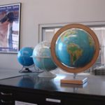
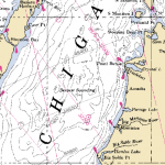 The Robinson Map Library is home to just over 500,000 cartographic items including maps, charts, aerial photographs, atlases, gazetteers, globes, and digital geospatial data. The library is a robust academic research collection with materials that span the globe. While there are demonstrated collection strengths in the midwest region (primarily Wisconsin), past and present international research conducted at the University has facilitated additional collection strengths in the areas of Africa, Europe, and Southeast Asia.
 While more contemporary in nature, the library’s map collections are primarily dated 20th century and later. As a Regional Federal Depository Library for cartographic materials, the Robinson Map Library receives print and digital maps, charts, atlases, geospatial data, and all other cartographic works produced by federal agencies such as (but not limited to) the United States Geological Survey (USGS), the United States Department of Agriculture (USDA), the National Park Service (NPS), the National Oceanic and Atmospheric Administration (NOAA), and the US Forest Service (USFS).
GIS Data
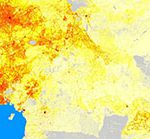 Wisconsin local government geospatial data is collected and archived for use in research and teaching at UW-Madison. With over 1Tb of data in the library archive, layers like tax parcels, roads, address points, land use, zoning, hydrography and municipal boundaries can be accessed by students, faculty, and staff of UW-Madison. Full inventories of data holdings can be viewed from the Collections menu above.
Aerial Imagery
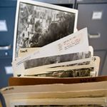
The Robinson Map Library is also home to the largest collection of historic aerial photography in Wisconsin. With over 260,000 individual prints, this impressive aerial collection gives us views of the state going back to 1937. Collections include imagery flown by the United States Department of Agriculture, the United State Geological Survey, the Wisconsin Department of Natural Resources, and various Wisconsin county government offices. Imagery from the oldest aerial survey of Wisconsin (1937-1941) flown by the USDA has been digitized and can be viewed and downloaded via the Wisconsin Historic Aerial Image Finder
Other items
 Bound volumes consist primarily of reference materials such as atlases, gazetteers, soil surveys, and plat books. With sheet maps being the primary medium of materials in the Robinson Library, larger collections of atlases, books, and academic journals can be found at the Geography Library.