All lectures are presented fully online via Zoom every Friday at 3:30 PM. The link to join the meeting is https://go.wisc.edu/l880yf except when otherwise indicated. Alumni, friends and the public are always invited to attend.
February 27th- Beyond 1862: Indigenous Lands Dispossession in Wisconsin
Panel participants: Ruth Goldstein, Caroline Gottschalk, Hilary Hunt, Kasey Keeler, and Joseph Mason
In 2020, High Country News published Land Grab Universities, an article outlining the relationship between the Morrill Act of 1862—used to fund land-grant universities—to Indigenous land dispossession. In the wake of this article, a group of scholars at UW gathered to investigate the university’s own relationship to dispossession, and the broader, overlapping processes of dispossession within the state. Following years of research, they published a series of educational modules: Indigenous Lands Dispossession in Wisconsin. Please join us for a panel discussion with the team behind the modules, who will describe the project, their process, and discuss the challenges of teaching and researching dispossession.
The panel also serves as the introduction to the 12th Annual Cartography Lab Design Challenge, Visualizing Dispossession, Envisioning Land Back, which will take place the next day. Registration for the design challenge is closed.
*This event will not be livestreamed*

March 20th –The climate and weather of rivers: characterizing channel dynamics across scales
Assistant Professor Claire Masteller, Washington University – St. Louis
Mountain rivers are dynamic systems that both record and respond to changing water and sediment fluxes. Yet distinguishing when a river is stable versus actively adjusting to a new state remains one of the central challenges in geomorphology. This seminar will explore how river channel geometry reflects both the “climate” and the “weather” of river systems—the long-term conditions that shape form and the short-term events that drive river channel change. We first examine how variability in bankfull geometry across diverse U.S. rivers reveals an extractable signature of differing flood frequencies between rivers. Then, we turn to extreme floods, highlighting results from Hurricane Helene in the Blue Ridge Mountains, where rapid satellite-based mapping reveals how pre-flood morphology predicts spatial patterns of channel widening and instability. Together, these studies demonstrate how remote sensing and high-resolution topographic analysis approaches can illuminate the processes that govern mountain river resilience.

April 10th –
Assistant Professor John Stehlin, UNC-Greensboro
April 17th –
Professor Patricia Ehrkamp, University of Kentucky
April 24th –
Assistant Professor Marcela Suarez, University of New Mexico
May 1st – Histories of Ordinary Landscapes
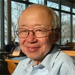
Professor Joseph Mason, University of Wisconsin-Madison
My primary research and teaching interest has been the histories of ordinary landscapes, in the Midwest, the Great Plains and elsewhere, those that don’t draw much attention from tourists or many geomorphologists for that matter. I use history broadly here, to include evolution over geologic time as well as the effects of people, both before and after the advent of settler colonialism. I use landscape narrowly to mean the physical, hydrological, and biological features of the land surface, from drumlins to drainage ditches. I will use two or three examples to demonstrate the extraordinary complexity of ordinary landscapes and their histories, how they are always transient, how their past history constrains but does not determine current change, and how, like politics and society, they can change little for long periods and then very rapidly. Along the way I may mention things I’m grateful to have learned from family, friends, students and colleagues, before and after finding my way to academia.