
Volume Four
- Promotional Flyer for Volume 4 here.
- 20% off purchase from the University of Chicago Press! Form here.
- Volume 4 Release Events schedule here.
![]()
Project Activities
IMCoS features the Enlightenment
Volume Four editors Matthew Edney and Mary Pedley were pleased to prepare an essay discussing Volume Four, Cartography in the European Enlightenment, for the excellent journal of the International Map Collector’s Society; we thank the editor of The IMCoS Journal for permission to make the essay available online (PDF available here).
ICHC 2019 in Amsterdam

This particular ICHC was the first for research editor Lindsey Buscher, who reports learning a great deal from her conversations with many Volume Five contributors, including associate editor Carla Lois.
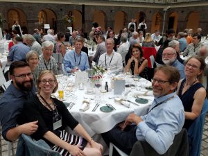 Editors and staff attended the July 2019 International Conference on the History of Cartography, organized by the Collections Department of the University of Amsterdam and held at the Royal Tropical Institute. The ICHC is held every two years and is a wonderful venue for Project staff and editors not only to meet contributors to discuss their work but also to inform the community as a whole about our progress. This ICHC was large and well attended, with 103 papers, 20 posters, and almost 280 attendees.
Conserving a 100-year-old map
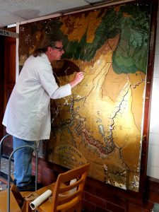
Conservator Craig Deller works on the map, which hangs in Science Hall at UW-Madison.
Over the course of the last several months, a team has worked hard to conserve the largest of several historic relief models that hangs in Science Hall at UW-Madison, home to the History of Cartography Project. This map, which shows the Grand Canyon, is part of a series that was created between 1870-1930 for classroom use. Because of its size and the extent of damage, this particular map had not been treated along with many of the others in 2013. Now, thanks to the combined efforts of Project members, professional conservators, and the State Cartographer’s office, the map will continue to serve as a learning tool for generations to come.
Special thanks to Rosalind Woodward and the UW-Madison Department of Geography for their financial support of this project.
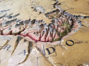
A detail of the map before cleaning and restoration.
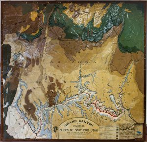
The relief model after cleaning and restoration. Photo by Sarah Stankey.
History of Cartography translation project
The first three volumes of The History of Cartography will be published in Mandarin in 2020, completing a translation project that began in 2014.
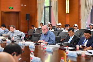 History of Cartography Project director Matthew Edney and Volume Five editor Roger Kain recently attended a seminar on the History of Cartography Translation Project at Yunnan University in China (https://bit.ly/31GElAA). At the conference, Edney spoke to fellow participants about the History of Cartography Project, which since its founding has aimed for a more global vision of maps and their history.
Want even more map news?
Please consider subscribing to a new, multilingual, international discussion forum for map history, part of the expansive H-NET community. Instructions to subscribe can be found at https://networks.h-net.org/node/4879599/discussions/5130718/announcement-introducing-h-maps-network-about-making-circulation
Follow us on Facebook (HistoryofCartographyProject) for updates on the Project and other news.