The Geospatial Data Science (GeoDS) Lab at the University of Wisconsin-Madison
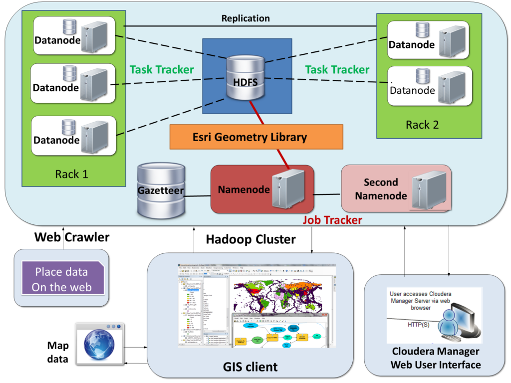
Geospatial Big Data is an extension to the concept of Big Data with emphasis on the geospatial component and under the context of geography or geosciences. It is used to describe the phenomenon that large volumes of georeferenced data (including structured, semi-structured, and unstructured data) about various aspects of the Earth environment and society are captured by millions of environmental and human sensors in a variety of formats such as remote sensing images, crowdsourced maps, geotagged videos and photos, transportation smart card transactions, mobile phone data, location-based social media content, and GPS trajectories. Big Geo-Data is “big” not only because it involves a huge volume of georeferenced data, but also because of the high-velocity of generation streams, high dimensionality, high variety of data forms, the veracity (uncertainty) of data, and the complex interlinkages with (small) datasets that cover multiple perspectives, topics, and spatiotemporal scales. In the GeoDS Lab@UW-Madison, we conduct researches during the life cycle of large-scale georeferenced data collection, access, storage, management, analysis, modeling, and visualization by utilizing spatial statistics and machine learning approaches. Research areas range from geospatial artificial intelligence (GeoAI), human mobility, urban informatics, transportation, public health, to location business intelligence, and so on. You can check out the GeoDS Lab’s Github for more research project information.
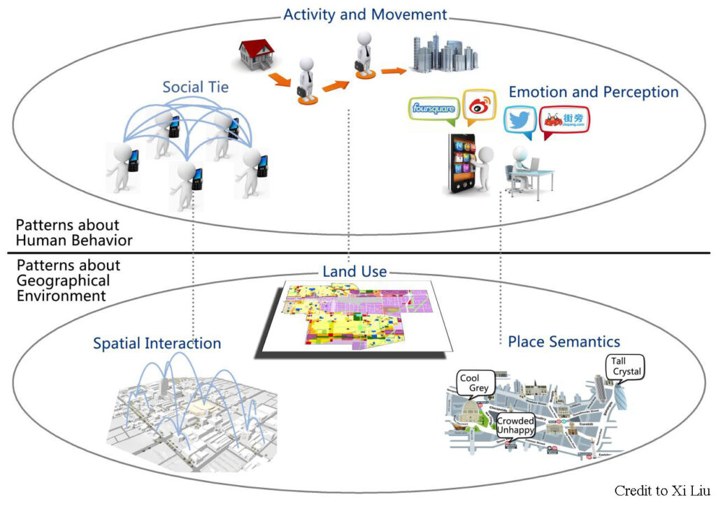
We are looking for visiting scholars who are interested in Place-Based GIS, Spatio-temporal Data Mining, Machine Learning and Deep Learning, GeoAI, Spatial Networks, Location-based Social Media, and Geospatial Big Data Analytics, etc. Please send your CV to song.gao [at] wisc.edu if you are interested.