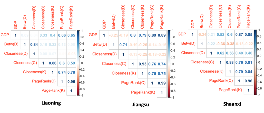
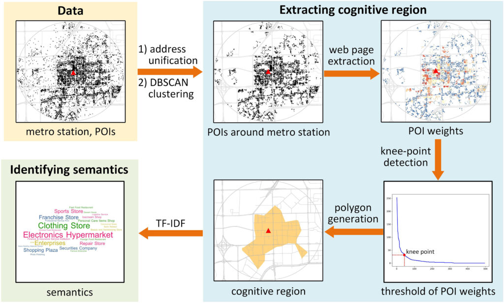
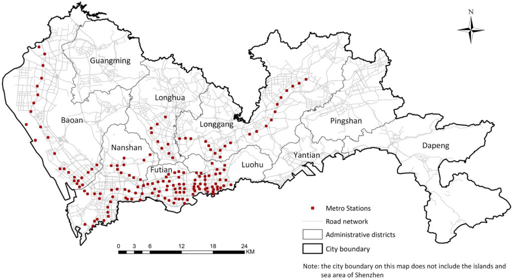
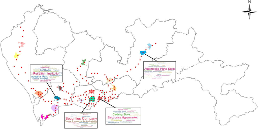
Geography According to Foundation Models
Editors: Krzysztof Janowicz, Rui Zhu, Gengchen Mai, Song Gao, Yingjie Hu, Zhangyu Wang, Ling Cai, Lauren Bennett
ISBN: 978-1-64368-659-2 (online), Open Access: https://ebooks.iospress.nl/volume/geography-according-to-foundation-models
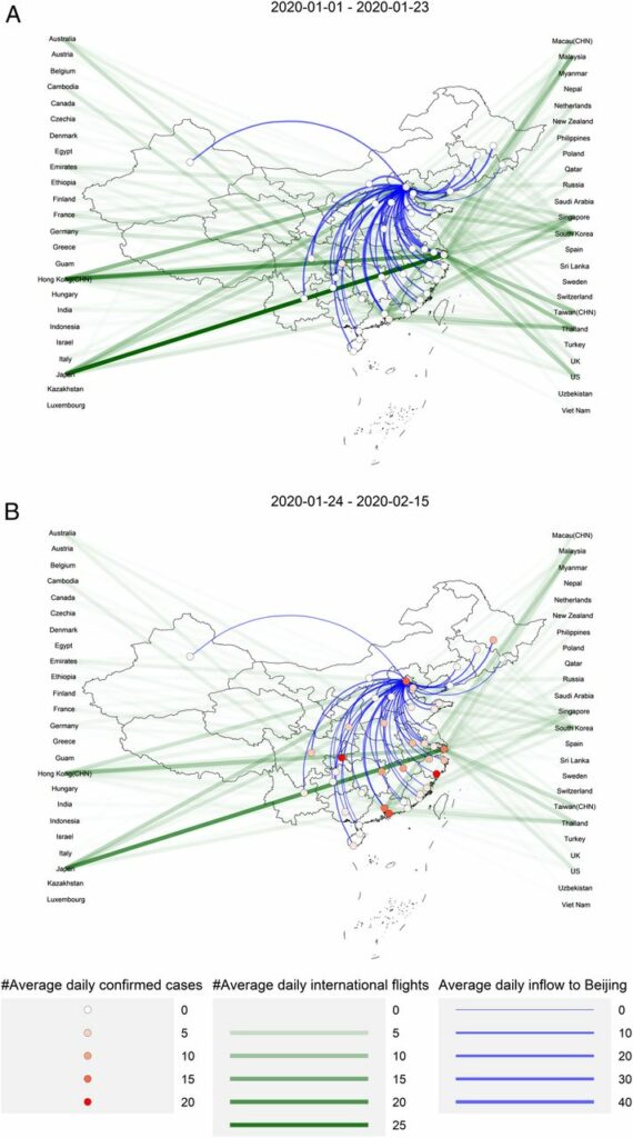
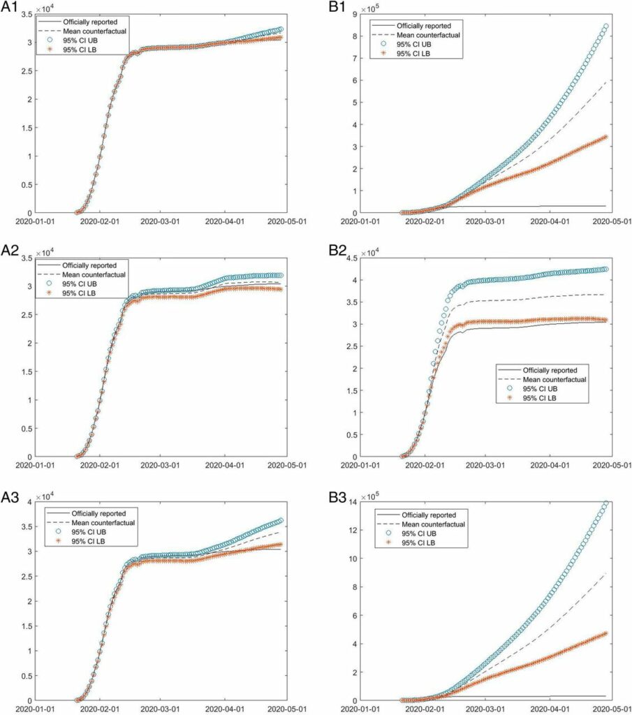
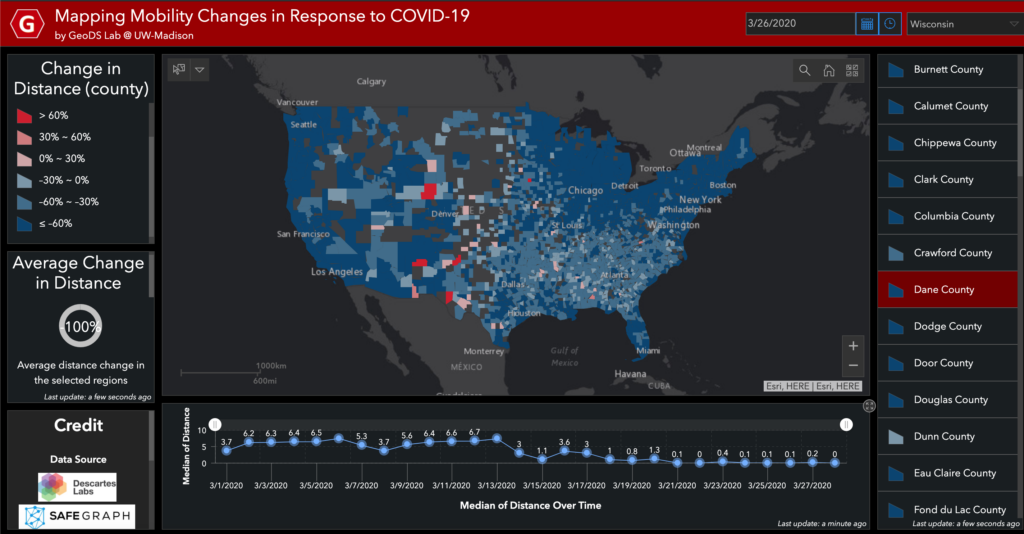
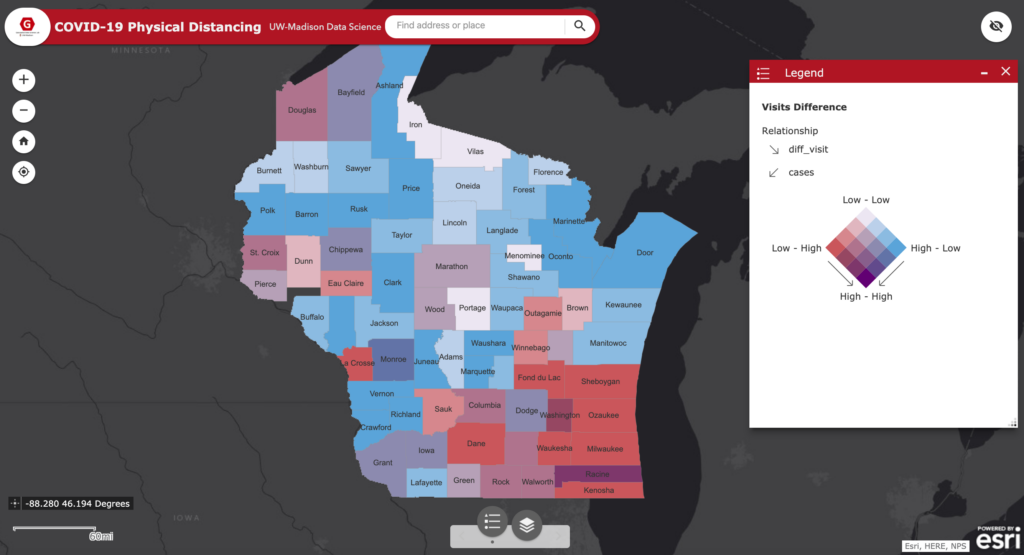
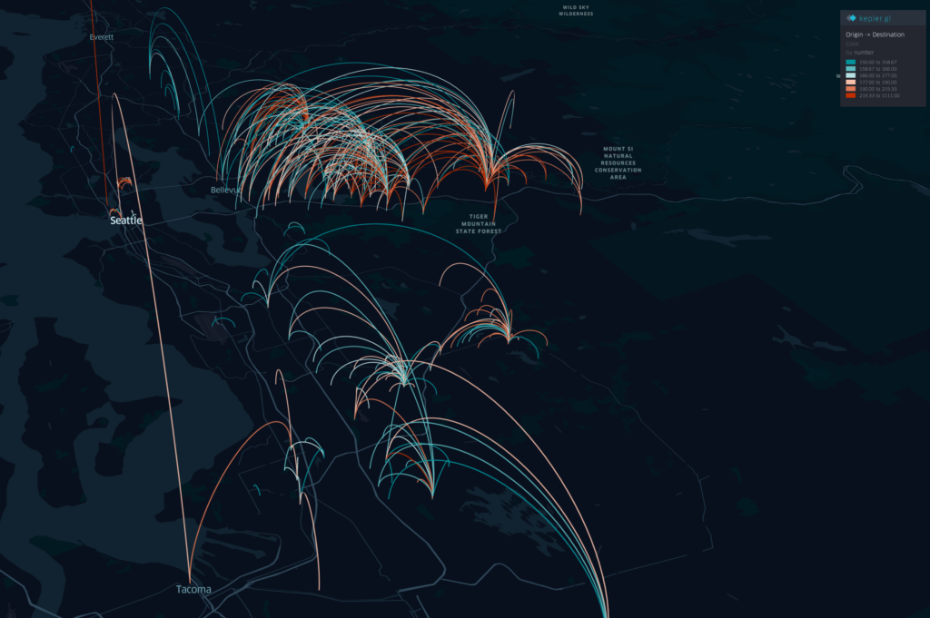
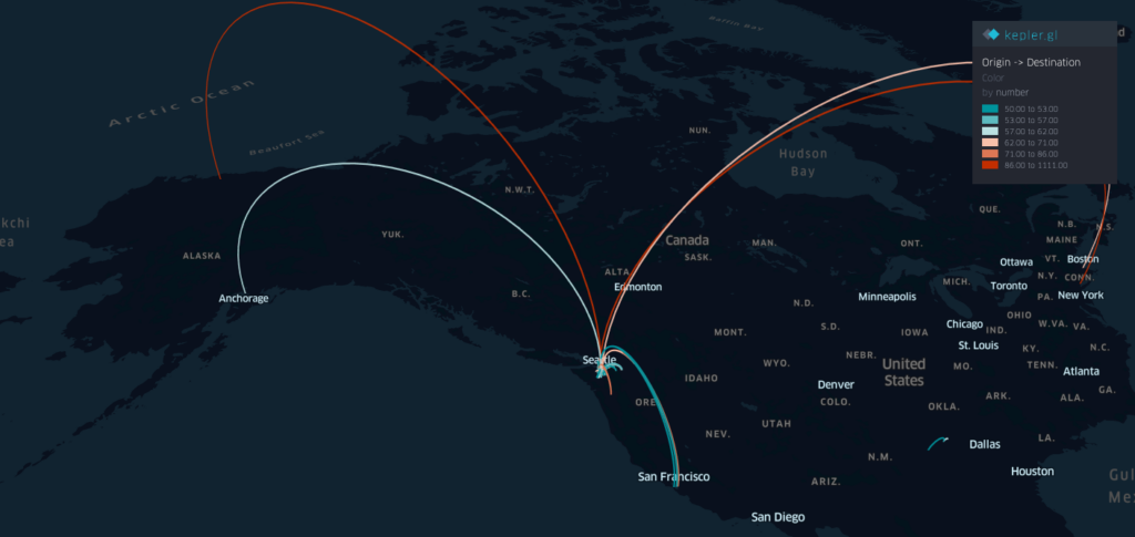
As generative AI continues to evolve, the geographic community has an important role to play in shaping how these technologies represent space, understand place, and influence how people engage with the world. This edited volume, Geography According to Foundation Models, explores the opportunities and challenges faced as generative AI intersects with geographic knowledge, spatial reasoning, and Geographic Information Science (GIS); a discipline long concerned with the representation, analysis, and interpretation of geographic data to help us to understand the world around us. AI, which can generate, transform, manipulate, synthesize, and interpret various data modalities, has given rise to new opportunities for geographic knowledge discovery, while at the same time presenting challenges around trust, bias, brittleness, explainability, and pedagogy. The 14 chapters included here bring together the work of researchers studying how systems increasingly facilitated by AI are representing geographical processes. Contributions are grouped into 5 parts: foundations and frameworks; methods and applications; interpretability and evaluation; impacts on education; and trust, bias, and beyond, and cover topics which explore advancing the technical foundation of GeoAI and geospatial foundation models; leveraging large language models (LLM) for geographic information retrieval and behavior simulation; investigating how foundation models extract, perceive, and represent geographic information; the disruptive pedagogical implications of AI for geography and GIScience; and the socio-technical foundations of developing and adopting foundation models in geographic contexts. Exploring the intersection of AI with geographic knowledge, this volume will be of interest to geographers, data scientists, AI researchers, educators, and policymakers.