The travels and close contact-tracing from/to infected communities is useful for identifying potential hotspots and assessing the potential risk across different places. A recent research published in Science showed that “substantial undocumented infection facilitates the rapid dissemination of novel coronavirus (SARS-CoV2) “. Understanding the human physical movement patterns and social contacts is a key for saving more lives as one may be surrounded by latent exposed people who don’t show SARS-CoV2 symptoms. Therefore, human mobility patterns and changes could be one indicator for understanding the status of physical social distancing. Here are the neighborhood mobility pattern and the Spring 2019 and March 2020 travel patterns for US cities and counties using the anonymized and aggregated mobile phone location big data in collaboration with SafeGraph, which covers over 3.6 million points of interest (POI) and business venues with visit patterns. Meanwhile, we are working on the whole US 2020 census block data and monitoring new infected areas from the CDC and from a list of Coronavirus dashboards in response to COVID-19.
Reference: Gao, S., Rao, J., Kang, Y., Liang, Y., & Kruse, J. (2020). Mapping county-level mobility pattern changes in the United States in response to COVID-19. SIGSPATIAL Special. 12(1), 16-26.

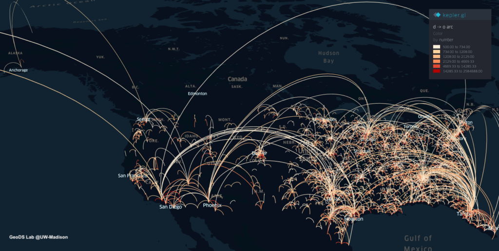
County-to-County Spring Travel Flows 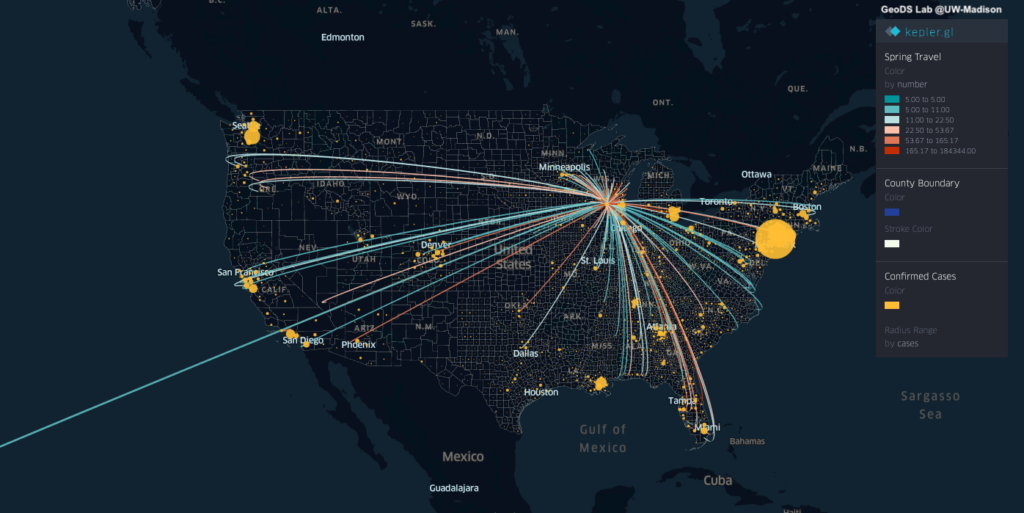
Dane County, WI
You can find out where people from those POIs / neighborhoods / a county connecting with other neighborhoods and counties across the US. By comparing the POI visits between last March and March 2020, we can summarize the changes and visualize the patterns on the maps to understand whether people in each County/State has reacted to (Physical) Social Distancing.
Interactive Web: Mapping Human Mobility Changes at the County level since March 1, 2020
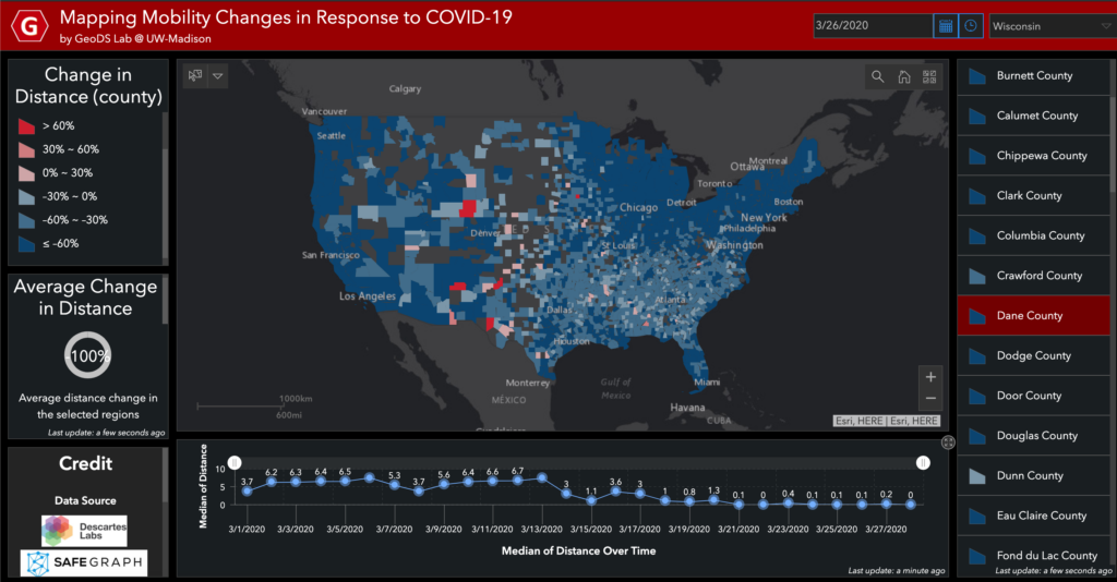
See also: https://www.nytimes.com/interactive/2020/03/23/opinion/coronavirus-economy-recession.html
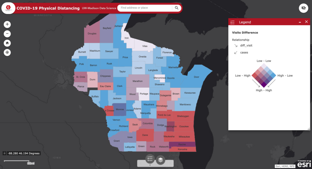
Interactive Web on COVID-19 Physical Distancing and the relation with the infectious cases in Wisconsin (Using the latest SafeGraph weekly movement patterns in March 2020): https://geods.geography.wisc.edu/covid19/WI/
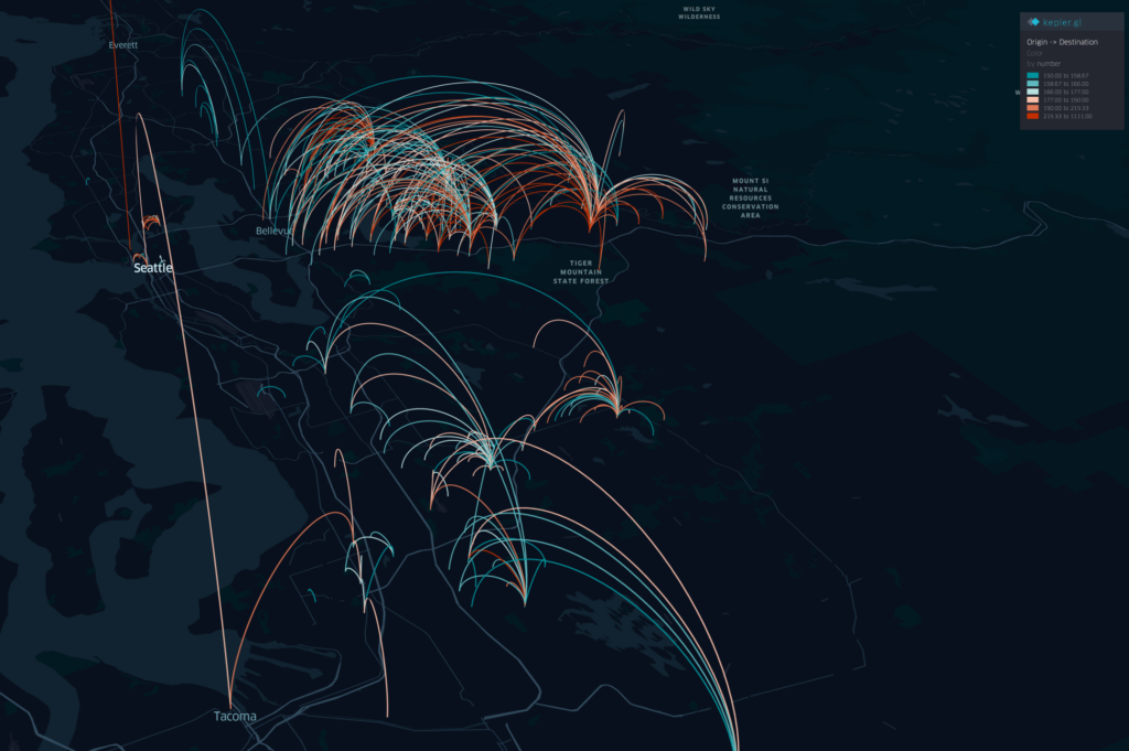
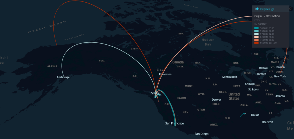
In addition, the maps below show the origin-destination (OD) flows larger than a travel frequency threshold at different spatial scales. The one at the urban scale can help understand the potential spread and hotspots in a city/metropolitan area.
Spring Travel Risk
By using the county-level Spring travel data in March, we can see thousands of trips generated from the U.S. counties in the Spring season and widely across the U.S., which may help explain the rapid growth of infection cases across the whole U.S. Our travel-augmented SEIR epidemic modeling results showed that only about 20% of infected cases reported (with testing) at the state level in the US.
Chen, S., Li, Q., Gao, S., Kang, Y.,& Shi, X.(2020). State-specific Projection of COVID-19 Infection in the United States and Evaluation of Three Major Control Measures. Scientific Reports, 1-9, www.nature.com/articles/s41598-020-80044-3.
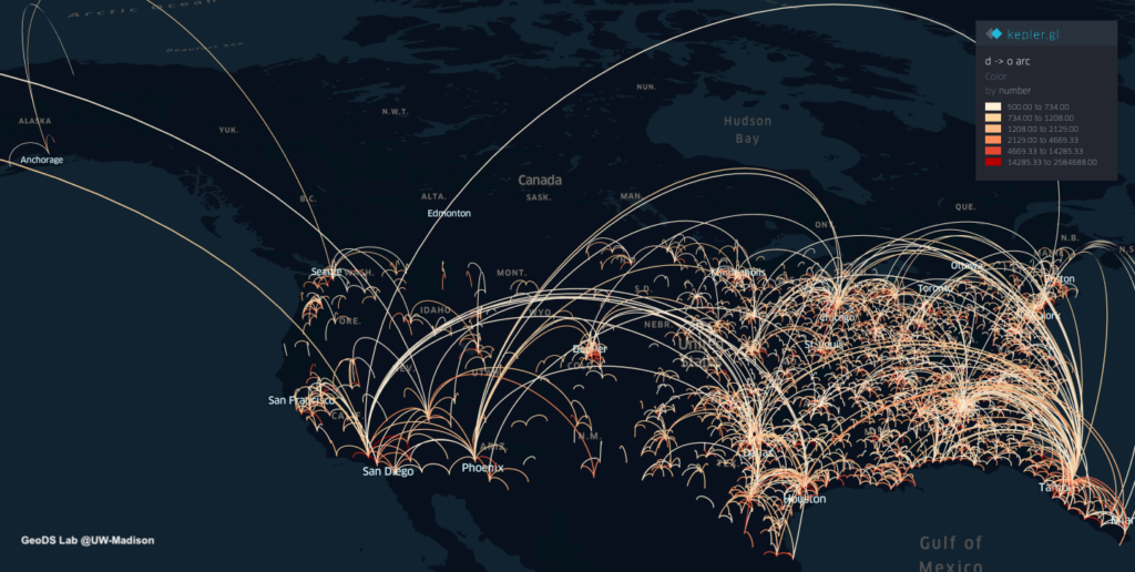
Interactive Web demo: Dane County, WI
The spring travels from the Dane County, WI with current U.S. confirmed cases: http://geods.geography.wisc.edu/covid19/WI_DaneCounty.html

Interactive Web: The King County, WA https://geods.geography.wisc.edu/covid19/KingCounty_Spring.html
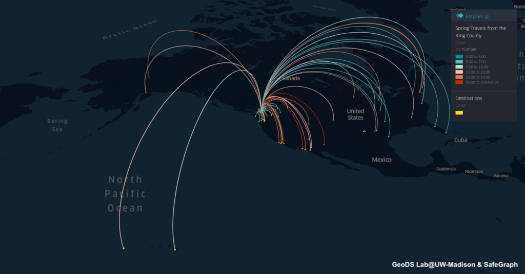
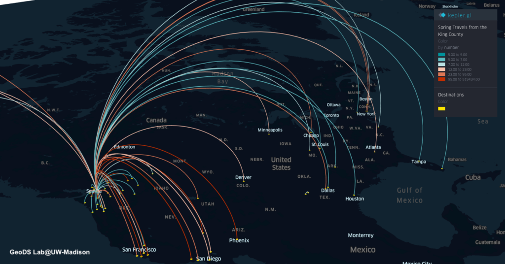
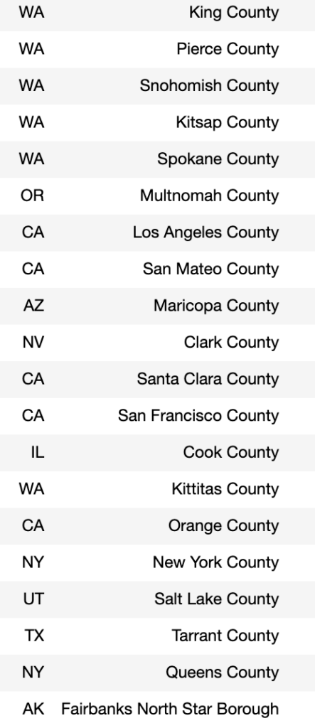
The following table shows the top 20 counties which the people reside in the King County traveled to in March 2019.
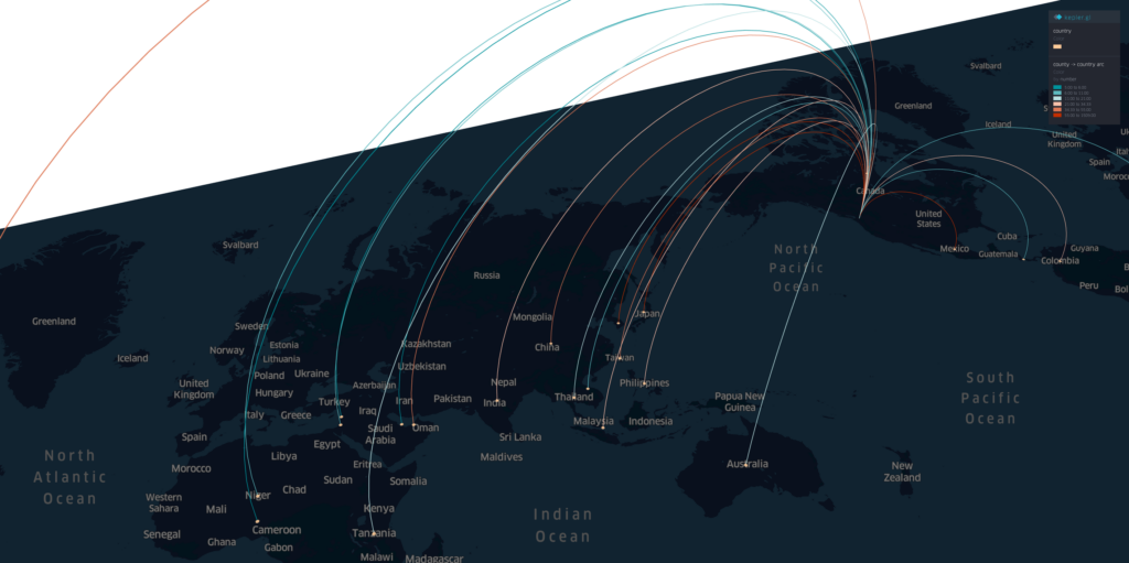
And using the Country-to-US Counties flow data from last March, we can assess how the global travels from other countries outside of US will influence the potential coronavirus outbreak and spread in the US.
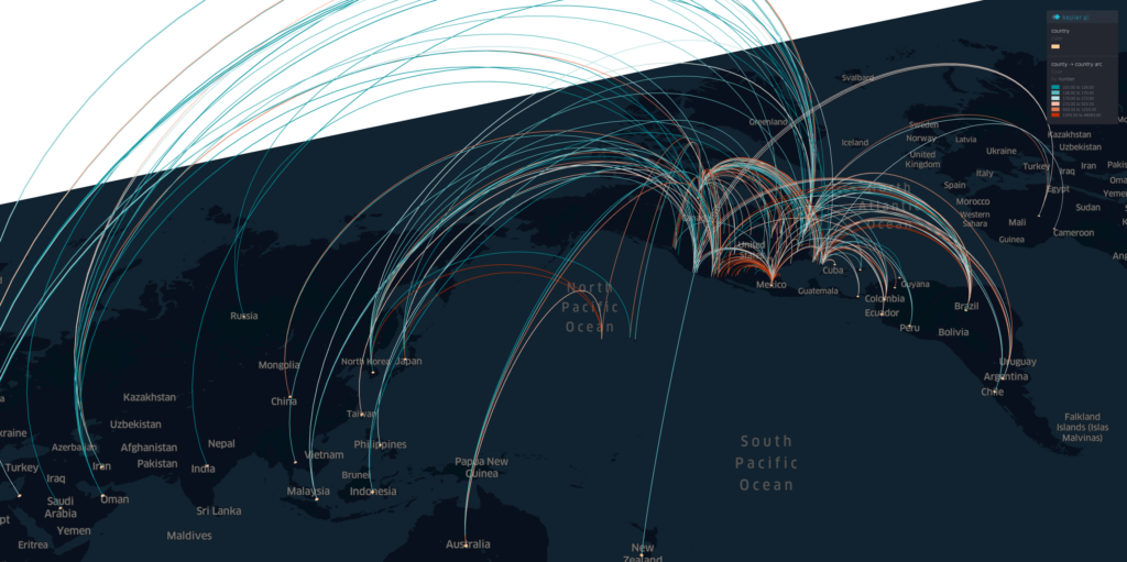
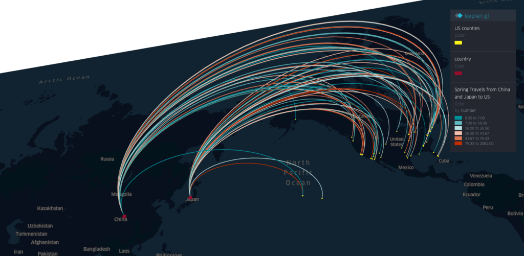
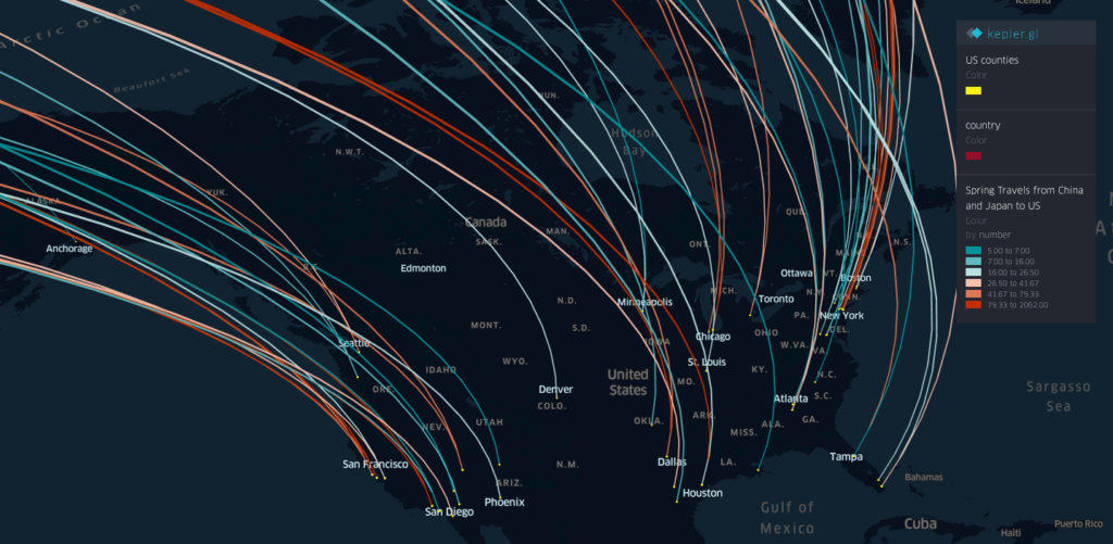
Credit: The data sources were from SafeGraph Inc., Descartes Labs, and the Web geovisualization was created using the Kepler.gl tool.
Acknowledgment: We would like to thank all individuals and organizations for collecting and updating the COVID-19 observation data and reports. Dr. Song Gao acknowledges the funding support provided by the National Science Foundation (Award No. 2027375). Any opinions, findings, and conclusions or recommendations expressed in this material are those of the author(s) and do not necessarily reflect the views of the National Science Foundation.