A street network is a system of interconnecting polylines and points (called edges and nodes in network science) that represent street segments/roads and intersections for a given area. It plays a very important role in transportation operation and management and many other fields. Below are some examples of research that we have been working on in this field.
(1) Street Centrality and Traffic Flow
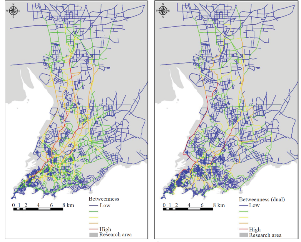
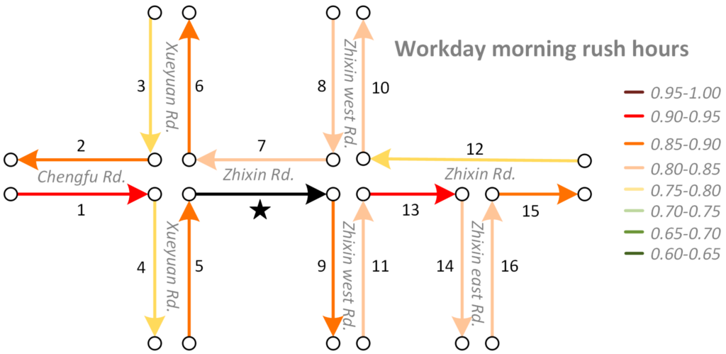
The structural and morphological properties of a street network, represented in topological or geographic metric measurements, are considered to be the key factors that shape dynamic urban traffic flow. Urban traffic flow can be seen as individual trips aggregately distributed in street networks. Each trip is generated from an origin and destination (OD) pair or multiple destinations with a network path connecting them. Generally, urban planners and transportation engineers rely on household questionnaires or transportation surveys on job–housing places for traffic-demand forecasting. With the rapid development of information and communication technology (ICT), the availability of large amounts of GPS (Global Positioning System) data and mobile phone data over time and space has increased the capability for monitoring, visualizing, analyzing, and modeling urban dynamics. In this research we investigate the spatial distribution of urban traffic flow based on taxi trajectories in a city in China and compute the correlation between urban traffic fl ow and street betweenness centrality. The results confirm that purely betweenness centrality is not an ideal measure for predicting urban traffic flow. We analyze the characteristics of betweenness and point out the ‘gap’ between betweenness centrality and actual flow. The gap is filled by a framework taking into account the distance decay and the spatial heterogeneity of human activities.
(2) Ride-sharing and Street Networks
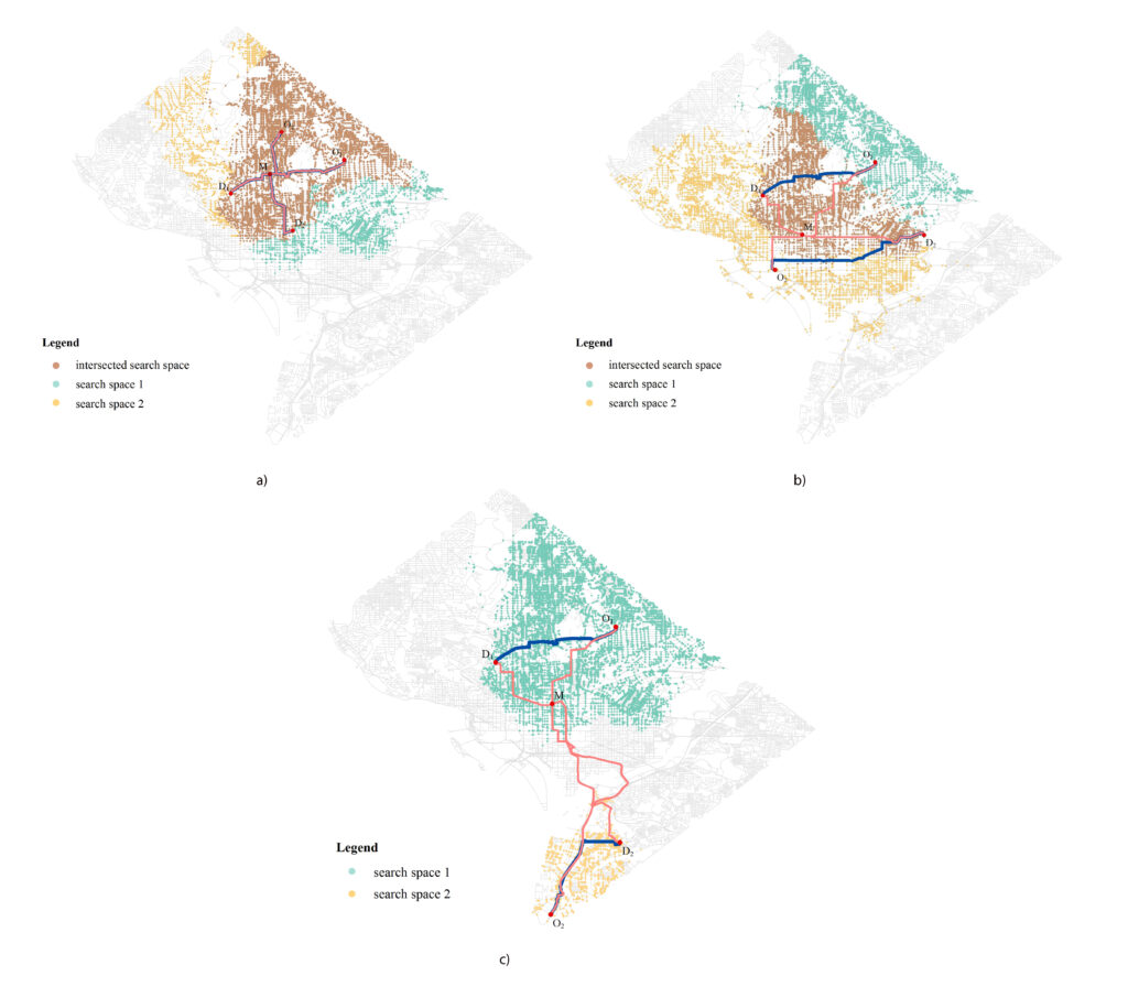
Given different types of constraints on human life, people must make decisions that satisfy social activity needs. Minimizing costs (i.e. distance, time, or money) associated with travel plays an important role in perceived and realized social quality of life. Identifying optimal interaction locations (e.g., for ride-sharing) along road networks when there are multiple moving objects (MMO) with space–time constraints remains a challenge. In this research, we formalize the problem of finding dynamic ideal interaction locations for MMO as a spatial optimization model and introduce a context-based geoprocessing heuristic framework to address this problem.
(3) Spatial Interactions along Street Networks
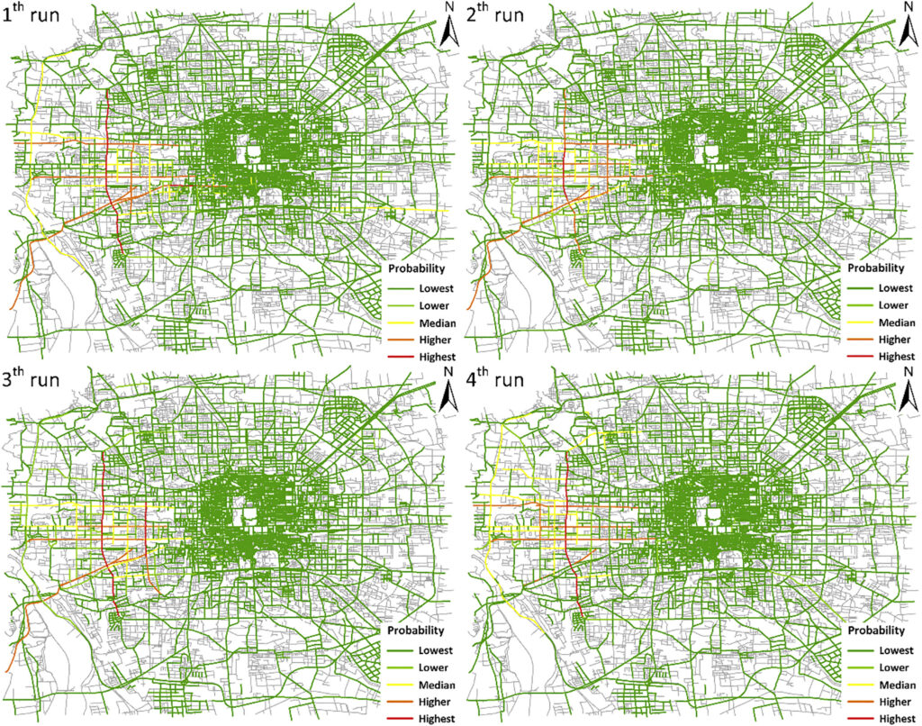
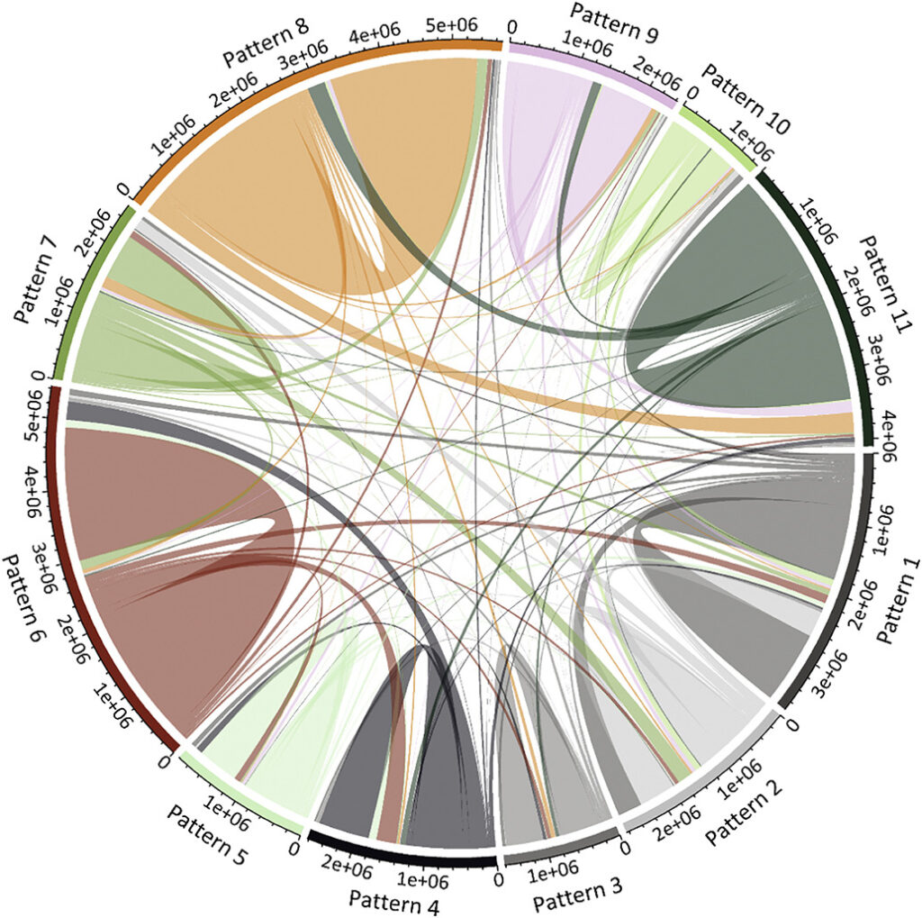
Researchers have proposed many methods to investigate the spatial interactions derived from human movements, such as the gravity model and the radiation model. However, most studies have mainly focused on the interactions among areal units at an aggregated level, neglecting that in most cases, human movements are carried by vehicles and constrained by the underlying road networks. To fill this gap, we propose a novel approach to identify spatial interaction patterns of vehicle movements along urban road networks.
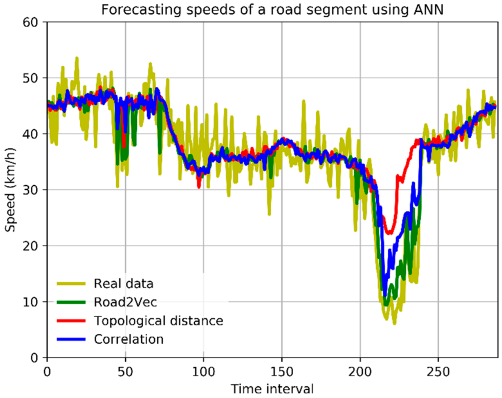
Good characterization of traffic interactions among urban roads can facilitate traffic-related applications, such as traffic control and short-term forecasting. Most studies measure the traffic interaction between two roads by their topological distance or the correlation between their traffic variables. However, the distance-based methods neglect the spatial heterogeneity of roads’ traffic interactions, while the correlation-based methods cannot capture the non-linear dependency between two roads’ traffic variables. In this paper, we propose a novel approach called Road2Vec to quantify the implicit traffic interactions among roads based on large-scale taxi operating route data using a Word2Vec model from the natural language processing (NLP) domain. A case study on short-term traffic forecasting is conducted with artificial neural network (ANN) and support vector machine (SVM) algorithms to validate the advantages of the presented method. The results show that the forecasting achieves a higher accuracy with the support of the Road2Vec method than with the topological distance and traffic correlation based methods.
(4) Public Transportation Optimization
Public transportation systems, in particular, bus systems, play an essential role in the process of urbanization. Typically more bus stops enable more people to access the bus whereas lower the efficiency of bus system. We utilize spatial optimization techniques to address this issue.
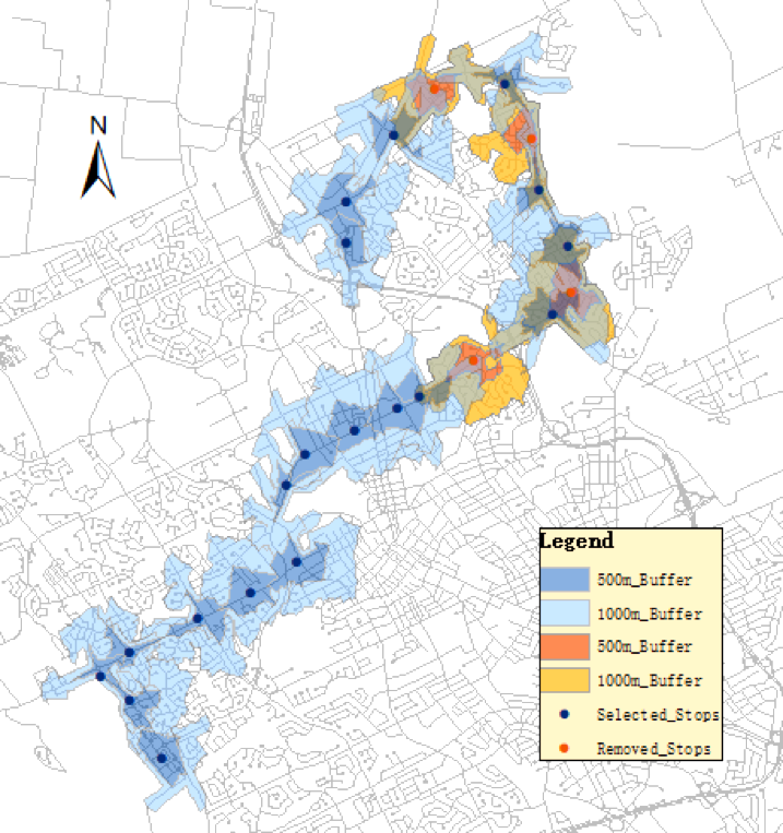
In one of our studies, we use the Spatial Interaction Coverage (SIC) model to identify and remove redundant bus stops while maintain the overall success of the whole bus system. The SIC model aims to model the relationship between demand points and bus stops. It takes factors such as the distance and the attractiveness of each bus stop into consideration. By applying the SIC model to the iXpress 202 route in Kitchener-Waterloo region in Canada, we can effectively identify the number of stops to maintain and remove redundant stops. The bus operation efficiency can be increased by 7.28% after optimization. The relationships between bus ridership and the socioeconomic variables (population, income, and age) in the study area are also analyzed. We are expanding our research to multiple cities with the consideration of multi-route buses and multi-mode transportation.
(5) Regional Economy and Transportation Network Analytics
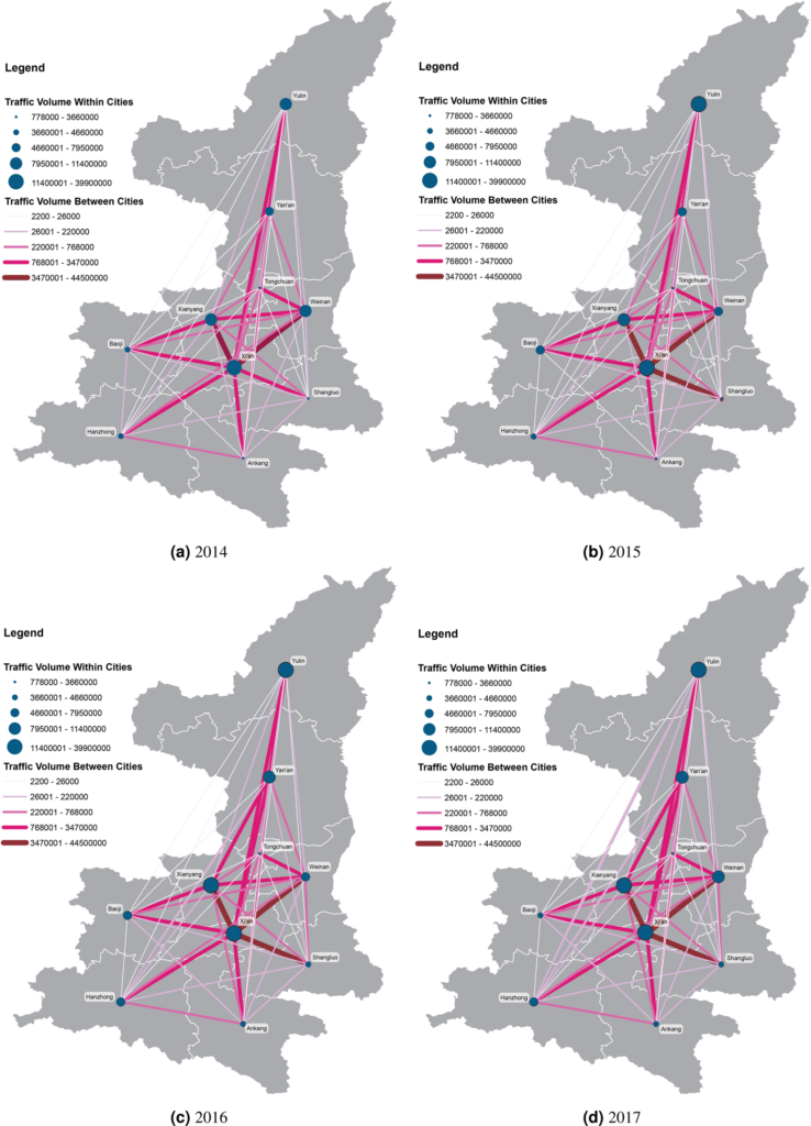
With the booming economy in China, many researches have pointed out that the improvement of regional transportation infrastructure among other factors had an important effect on economic growth. Utilizing a large-scale dataset which includes 3.5 billion entry and exit records of vehicles along highways generated from toll collection systems, we attempt to establish the relevance of mid-distance land transport patterns to regional economic status through transportation network analyses. We apply standard measurements of complex networks to analyze the highway transportation networks. A set of traffic flow features are computed and correlated to the regional economic development indicator. The multi-linear regression models explain about 89% to 96% of the variation of cities’ GDP across three provinces in China. We then fit gravity models using annual traffic volumes of cars, buses, and freight trucks between pairs of cities for each province separately as well as for the whole dataset. We find the temporal changes of distance-decay effects on spatial interactions between cities in transportation networks, which link to the economic development patterns of each province. We conclude that transportation big data reveal the status of regional economic development and contain valuable information of human mobility, production linkages, and logistics for regional management and planning. Our research offers insights into the investigation of regional economic development status using highway transportation big data.
References:
Gao, S., Wang, Y., Gao, Y., & Liu, Y. (2013). Understanding urban traffic-flow characteristics: a rethinking of betweenness centrality. Environment and Planning B: Planning and Design, 40(1), 135-153.
Gao, S., Yang, J. A., Yan, B., Hu, Y., Janowicz, K., & McKenzie, G. (2014, September). Detecting origin-destination mobility flows from geotagged Tweets in greater Los Angeles area. In Eighth International Conference on Geographic Information Science (GIScience’14).
Lee, J. H., Gao, S., & Goulias, K. G. (2015). Can Twitter data be used to validate travel demand models. In 14th International Conference on Travel Behaviour Research.
Liu, K., Gao, S., Qiu, P., Liu, X., Yan, B., & Lu, F. (2017). Road2Vec: Measuring Traffic Interactions in Urban Road System from Massive Travel Routes. ISPRS International Journal of Geo-Information, 6(11), 321.
Wang, S., Gao, S., Feng, X., Murray, A. T., & Zeng, Y. (2018). A context-based geoprocessing framework for optimizing meetup location of multiple moving objects along road networks. International Journal of Geographical Information Science, 32(7), 1368-1390.
Liang, Y., Gao, S., Wu, T., Wang, S., & Wu, Y. (2018, November). Optimizing Bus Stop Spacing Using the Simulated Annealing Algorithm with Spatial Interaction Coverage Model. In Proceedings of the 11th ACM SIGSPATIAL International Workshop on Computational Transportation Science (pp. 53-59). ACM.
Liu, K., Gao, S., Lu, F. (2019) Identifying spatial interaction patterns of vehicle movements on urban road networks by topic modelling. Computers, Environment and Urban Systems, 2019, 74, 50-61.
Yunlei Liang, Song Gao, Mingxiao Li, Yuhao Kang, and Jinmeng Rao (2019) Analyzing the Gap Between Ride-hailing Location and Pick-up Location with Geographical Contexts (Best Poster Award). In Proceedings of 1st ACM SIGSPATIAL International Workshop on Ride-hailing Algorithms, Applications, and Systems (RAAS’19)
Bin Li, Song Gao, Yunlei Liang, Yuhao Kang, Timothy Prestby, Yuqi Gao, and Runmou Xiao. (2020) “Estimation of Regional Economic Development Indicator from Transportation Network Analytics.”Scientific Reports, 10(2647), 1-15. DOI: https://doi.org/10.1038/s41598-020-59505-2